 Map of Westmorland

|

|
|
|
map type:- Bickham 1753-54 |
|
|
|
Maps, A Map of Westmorland, 1753, and A Map of
Cumberland, 1754, by George Bickham, James Street, Bunhill
Fields, London; published 1750s-96.
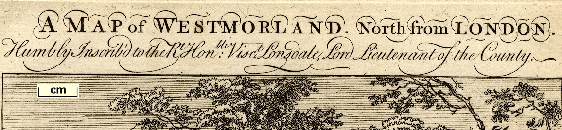
The maps are very inaccurate perspective views: if the image is manipulated to undo the perspective the resulting 'maps' have little relation to reality; given that the rules of perspective were well known this is sad. Published in 'The British Monarchy: Or, a New Chorographical Description of all the Dominions Subject to the King of Great Britain. Comprehending the British Isles, The Electoral States, The American Colonies, The African and Indian Settlemts. And enlarging more particularly on The respective Counties of England and Wales. To which are added Full and exact Lists of the Navy, the Army, the Officers of State, the Revenue, and Justice; with all the Salaries, as fix'd both by the Civil and Military Establishments. The Whole illustrated with suitable Maps and Tables; likewise, adorned with Head-Pieces, and other Embellishments; And Engrav'd by George Bickham. GB. Fecit. Publish'd according to Act of Parliament, October 1st. 1743. And sold by G. Bickham in James Street, Bunhill-Fields, & by the Booksellers and Printsellers in Town & Country. A further title page is 'A Description of the several Counties In South Britain; Containing, England and Wales. London: Sold by G. Bickham junr. in Mays Buildings Covent Garden, according to Act of Parliament March 29th 1750. N.B. Whosoever coppy the Maps shall be Sued as the Law directs, & by reason of ye Work contain'd in each Map, they must go as two Pages.' The atlas was issued in parts from 1743, the Westmorland map is dated 1753, Cumberland 1754, as a whole the atlas cannot have been issued before 1754; as well as maps which are birds eye views, it has descriptive text, tables of data, coats of arms, etc; its size is 7 1/2 x 12 1/2 ins. Another state of the title page includes '... To which are added Alphabets in all the Hands made use of in this Book. ...'; Bickham was a teacher of calligraphy and engraving. Published in another edition in 1749. Published in 'A Curious Antique Collection Of Birds-Eye Views Of The Several Counties In England & Wales; Exhibiting A Pleasing Landscape Of Each County; With A Variety Of Rustic Figures, Ruins, &c. &c. And The Names Of The Principal Towns And Villages, Interspersed According To Their Apparent Situation. Finely Engraved on Forty Six Plates. By George Bickham, Junior, London: Published By Robert Laurie And James Whittle, Map, Chart, And Print Sellers, No.53, Fleet Street, (Successors To The Late Mr. Robert Sayer.) 1796. The birds eye view map is unchanged, but notes imprint and date are cut off the bottom, some of the notes at the top cut off, and the title re-engraved; the atlas size is 7 1/2 x 10 3/4 ins. |
||
|
(example Armitt Library : ALMC2008.14.71)
|
||
| inscription:- |
printed top
A MAP of WESTMORLAND. North from LONDON. / Humbly Inscribed to the Rt. Honble : Visct. Lonsdale, Lord Lieutenant of the County. |
|
| inscription:- |
printed bottom
From London to Kendall 256m. Principal Town from Kendal Ambleside 13 / Kirkby Lonsdale 9. Appleby 26. Kirkby Steven 21. Brough 12. Orton 15. Burton 12. / Shap 18. / According to Act of Parliamt. by Geo. Bickham 1753. |
|
| wxh, sheet:- | 19.5x31.5cm | |
| wxh, plate:- | 156x256mm | |
| wxh, map:- | 148x211mm | |
| references:- |
Bickham, George snr: 1754 (?): British Monarchy, The & New
Chorographical Description of all the Dominions Subject to
the King of Great Britain: (London) Bickham, George jnr: 1796: Curious Antique Collection of Birds-eye Views of the Several Counties of England and Wales: (London) |
|
| sources:- |
Chubb 1927 (CLXXVIII) Hodson 1984 Armitt Library Kendal Library Maps Carlisle Library Maps |
|
| items seen (illustrated items in bold):- | ||

|
Armitt Library : ALMC2008.14.71 -- map -- Map of Westmorland | |
|
|
Armitt Library : ALMC2008.14.72 -- map -- Map of Westmorland | |
|
|
Carlisle Library : Map 62 -- map -- Map of Westmorland | |
|
|
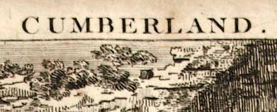
Carlisle Library (4_2) -- map -- Map of Cumberland North from London -- Cumberland | |
|
|
Kendal Library : Map 43 -- map -- Map of Westmorland | |