 County of York

|

|
|
|
map type:- Jefferys 1771 |
|
|
|
Map, A Topographical Survey of the County of York, scale
about 1 inch to 1 mile, by Thomas Jefferys, 1767-1771,
published by Robert Sayer and John Bennett, 53 Fleet Street,
London, 1775.
The map is on 20 sheets, arranged 5x4, with an index sheet showing their arrangement, an index of places, and a list of subscribers, bound between boards. The sheets which concern Cumbria are on the Westmorland border, plates I and VI. |
||
| map feature:- | pictorial cartouche (plate XX) & vignettes (Fountains Abbey and Middleham Castle) & coat of arms (of towns) & dedication (to Charles Watson Wentworth, Earl of Malton etc) & table of symbols (plate III) & compass rose & up is N & scale line (plate XVI, statute and geographical miles) & lat and long scales (based on the meridian of Greenwich) & index grid & sea plain & coast form lines & rivers & relief & hill hachuring & beacons & woods & forests & parks & county & hundreds (wapontakes) & settlements & roads & turnpike roads & canals & inset map (towns - Kingston upon Hull, Leeds, Ripon, Scarborough, Sheffield, York) | |
| inscription:- |
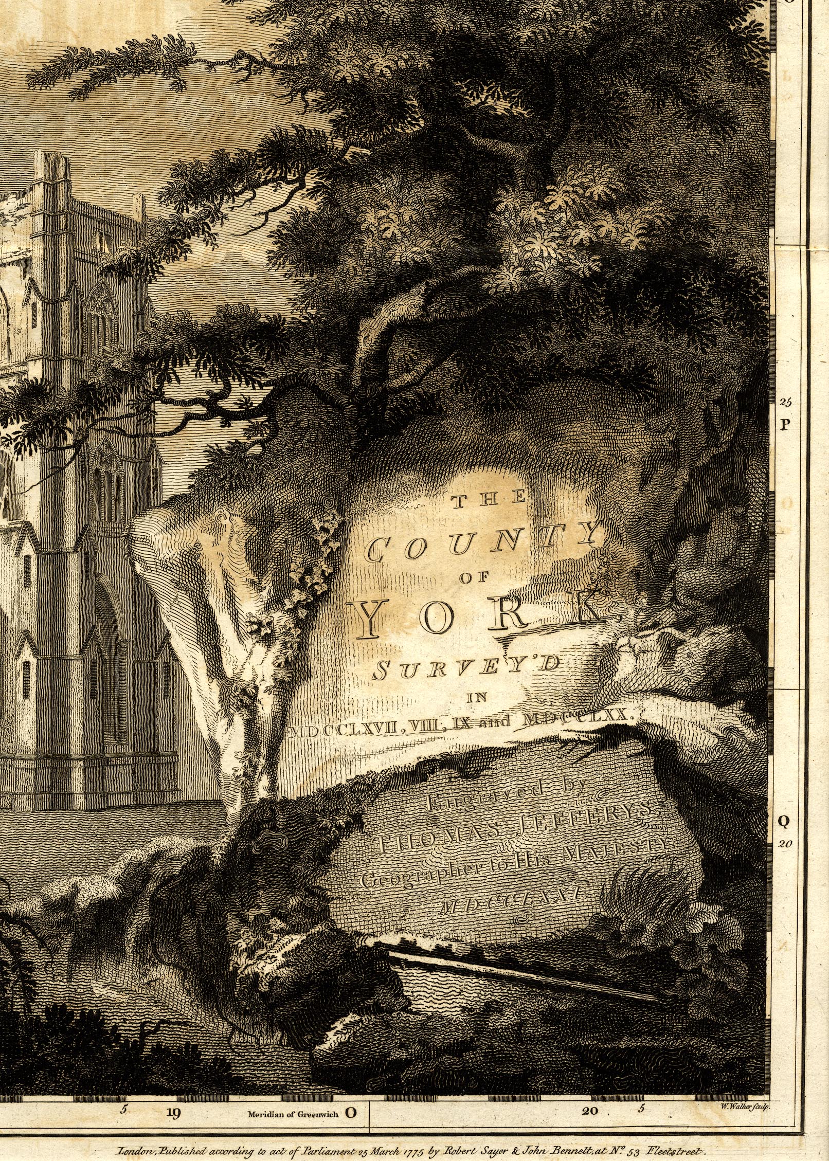
printed plate 20, title
THE / COUNTY / OF / YORK, / SURVEY'D / IN / MDCCLXVII, VIII, IX and MDCCLXX. / Engraved by / THOMAS JEFFERYS, / Geographer to His Majesty. / MDCCLXX1. |
|
| inscription:- |
printed bottom left, right of plate 20, referring to the
view of Fountains Abbey
N. T. Dall delin. / W. Walker sculpt. |
|
| inscription:- |
printed bottom right of plate 20 and other plates
London. Published according to act of Parliament 25 March 1775 by Robert Sayer and John Bennett, at No.53 Fleetestreet. |
|
| wxh, covers:- | 42x63cm | |
| inscription:- |
printed with scale line
Statute Miles 69 1/2 to a Degree. |
|
| scale line (statute):- | 6+1 miles = 175.9 mm | |
| inscription:- |
printed with scale line
Geographical Miles 60 to a Degree. |
|
| scale line (geographical):- | 6+1 miles = 203.9 mm | |
| scale:- | 1 to 64000 ? (1 to 64044 from statute scale line) | |
| inscription:- |
printed header of index pages
AN ALPHABETICAL LIST / OF THE / Towns, Villages, &c. in the County of York, and County of the City of YORK. / BEING AN INDEX TO THE / TOPOGRAPHICAL SURVEY of the County of YORK. / ON A SCALE OF ONE INCH TO A MILE. / By THOMAS JEFFERYS, Geographer to His MAJESTY. |
|
| sources:- |
private collection |
|
| items seen (illustrated items in bold):- | ||

|
private collection (196) -- map -- County of York -- Topographical Survey of the County of York | |
|
|
private collection (196_1) -- map -- Environs of Muker and Lune and Stainmoor Forests -- County of York | |
|
|
private collection (196_6) -- map -- Environs of Sedbergh, Dent, Hawes, Askrigg, and Settle -- County of York | |