 Jefferys 1771

|

|
|
|
item:- private collection (196_1) image:- © see bottom of page |
click to enlarge |
|
|
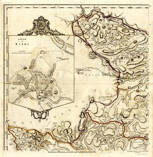
Map, hand coloured engraving, The Environs of Muker and
Lune and Stainmoor Forests, scale about 1 inch to 1 mile, by
Thomas Jefferys, 1767-1771, published by Robert Sayer and
John Bennett, 53 Fleet Street, London, 1775.
Plate 1 of A Topographical Survey of the County of York. With an inset plan of Ripon. |
||

|
Jefferys 1771 | |
| inscription:- |
printed bottom
The ENVIRONS of MUKER and LUNE and STAINMOOR FORESTS. / Corrected & Published according to act of Parliament / 25 March 1775. |
|
| wxh, sheet:- | 62x78.5cm | |
| wxh, plate:- | 608x613mm | |
| wxh, map:- | 580x587mm | |
| scale:- | 1 to 64000 ? (1 to 64044 from statute scale line) | |