 OS One Inch map 3rd edn (large sheet series) &
map
OS One Inch map 3rd edn (large sheet series) &
map

|

|
|
|
map type:- OS 1907 3rd edn large sheet |
|
|
|
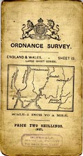
Maps, One Inch 3rd edition large sheet maps of Great
Britain, scale 1 inch to 1 mile, published by the Ordnance
Survey, Southampton, Hampshire, 1907-13.
The maps were available in different covers - Ellis Martin designs, red and brown on buff, or black on buff; White with index sheet; or retail agents covers. The sheets that concern Westmorland, Cumberland, and the parts of Lancashire north of the sands, and of Yorkshire, that became Cumbria are ???:- sheet 3 - Otterburn sheet 5 - sheet 6 - Haltwhistle sheet 8 - sheet 9 - Carlisle and Penrith sheet 10 - sheet 12 - Whitehaven and Keswick sheet 13 - Ulswater and Ambleside sheet 14 - sheet 18 - Barrow in Furness and Coniston sheet 19 - Kendal sheet 20 - Hawes |
||
|
||
| sources:- |
JandMN Collection private collection Carlisle Library Maps |
|
| sources:- |
|
|
| items seen (illustrated items in bold):- | ||

|
Carlisle Library : Map 353 -- map -- Barnard Castle and Kirkby Stephen | |
|
|
JandMN (179) -- map -- Kendal -- Kendal and District | |
|
|
JandMN (180) -- map -- Ullswater and Ambleside -- Ullswater and District | |
|
|
JandMN (181) -- map -- Hawes and Leyburn -- Hawes and District | |
|
|
JandMN (183) -- map -- Haltwhistle | |
|
|
JandMN (184) -- map -- Barrow in Furness and Coniston -- Barrow-in-Furness | |
|
|
JandMN (411) -- map -- Carlisle and Penrith -- Carlisle and District | |
|
|
JandMN (431) -- map -- Whitehaven and Keswick | |
|
|
JandMN (432) -- map -- Longtown | |
|
|
JandMN (433) -- map -- Wear Dale and District -- Wear Dale | |
|
|
private collection (121) -- map -- Kendal | |