 Map of the Trout and Salmon Waters of England and
Wales
Map of the Trout and Salmon Waters of England and
Wales

|

|
|
|
map type:- British Field Sports Society 1950s |
|
|
|
Map of the Trout and Salmon Waters of England and Wales,
acessible to visitors, scale about 15 miles to 1 inch, by
Edward Standford, 12-14 Long Acre, published by the British
Field Sports Society, 3 St James's Square, London, 1950s?
There is an included booklet describing each water and the availability of tickets. |
||
|
(example JandMN (461))
|
||
| map feature:- | up is N & scale line & lat and long scales (conical projection) & sea tinted & coast line & rivers & lakes & county & settlements & fishing | |
| inscription:- |
printed cover
MAP / OF THE / TROUT AND SALMON / WATERS OF / ENGLAND & WALES / ON WHICH VISITORD TICKETS ARE AVAILABLE / BRITISH / FIELD SPORTS / SOCIETY / PRICE 5/- NET / BRITISH FIELD SPORTS SOCIETY / President, the Duke of Beaufort, K.G., G.C.V.O. / 3 ST JAMES'S SQUARE, LONDON, S.W.1. green on yellow |
|
| inscription:- |
printed upper right
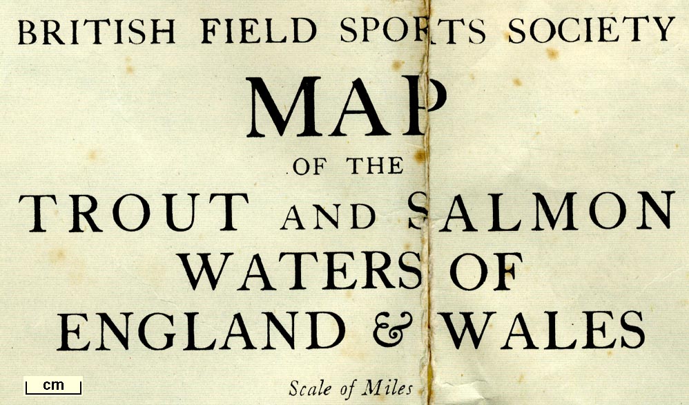
BRITISH FIELD SPORTS SOCIETY / MAP / OF THE / TROUT AND SALMON / WATERS OF / ENGLAND & WALES |
|
| inscription:- |
printed bottom
PRINTED IN GREAT BRITAIN Published by The British Field Sports Society, 3, St. James's Square, London, S.W.1. Copyright Edward Stanford Ltd / ... |
|
| wxh, cover:- | 12.5x20cm | |
| wxh, sheet:- | 56.5x71cm | |
| wxh, map:- | 540x666mm | |
| inscription:- |
printed with scale line
Scale of Miles |
|
| scale line:- | 50 miles = 83.9 mm | |
| scale:- | 1 to 960000 ? (1 to 959085 from scale line) | |

|
||
| sources:- |
JandMN Collection |
|
| items seen (illustrated items in bold):- | ||

|
JandMN (461) -- fishing map -- Map of the Trout and Salmon Waters of England and Wales | |