 Lea 1689

|

|
|
|
map type:- Lea 1689 |
|
|
|
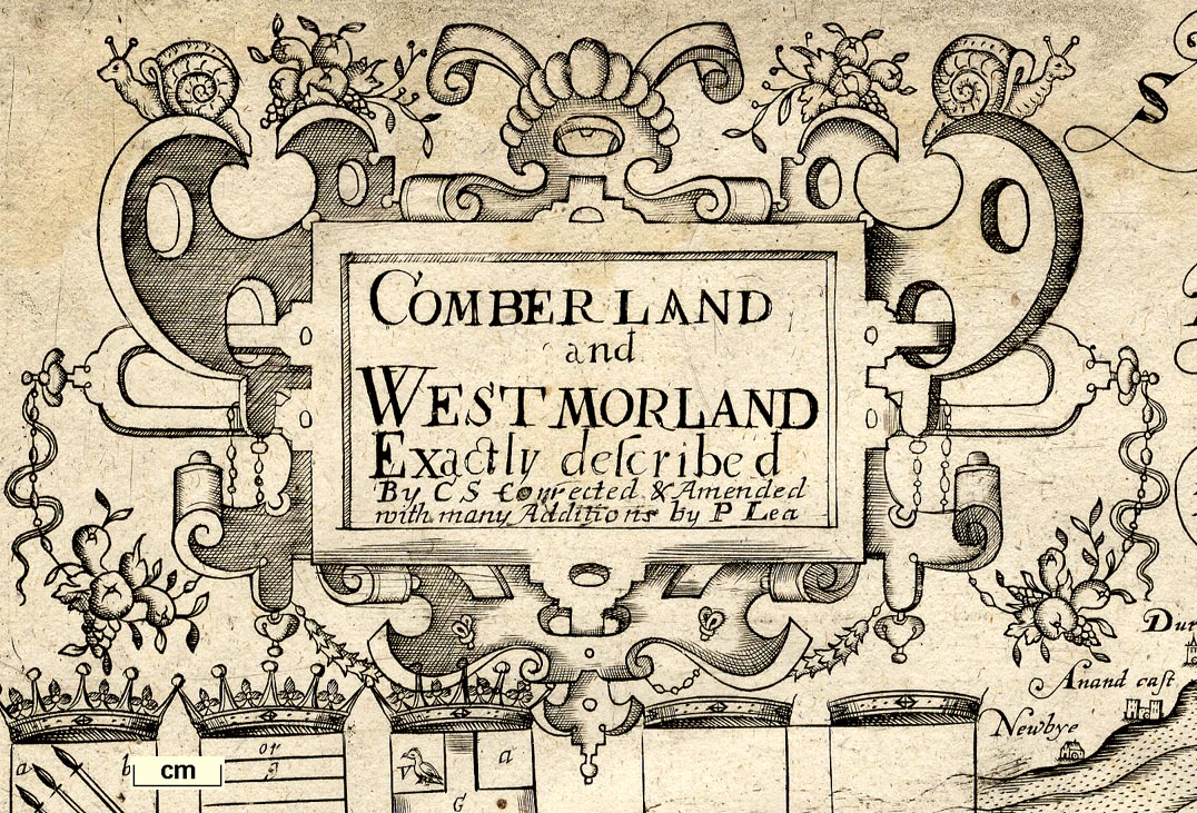
Map, Comberland and Westmorland, scale about 4 miles to 1
inch, altered from the map by Christopher Saxton, 1576,
amended and published by Philip Lea, London, about 1689 and
1693, then Willdey about 1732, Jefferys about 1749, Dicey
about 1772.
Published in 'All the Shires of England and Wales Described by Christopher Saxton Being the Best and Original Mapps With many Additions and Corrections by Philip Lea. Sold by Phillip Lea at the Atlas and Hercules in Cheapside near Friday Street and at his Shop in Westminster Hall near the Court of Common Pleas where you may have all sorts of Globes Mapps &ct.' about 1689. Published in 'The Shires of England and Wales Described by Christopher Saxton Being the Best and Original Mapps With many Additions and Corrections Viz: ye Hundds, Roads, &c. by Philip Lea. Also the new Surveis of Ogilby, Seller, &c. Sold by Phillip Lea ...' about 1693. Philip Lea's alterations are part of a continuing process of enriching Saxton's plates, and altering Latin to English, this began with some plates about 1665 though the edition was not printed; the additions are mainly from Speed's map. Changes include:- royal arms, and those of Seckford, erased; five shields added below the title cartouche, three with coats of arms, Marcatus E, Ran. Meschems, and Andrew Harkley, and two blank, below them five monumental columns; plan of Carlile lower left; displacing the scale to the right; the road to London from Carlisle, via Penrith and Kendal, added as well as other roads; crosses added to the few market towns. This is one of the earliest maps of Cumbria to show roads. And changes by 1693 include:- ward boundaries added; crown and mitre symbol added to Carlisle; some additional crosses for market towns; all Ogilby routes now shown, and other routes. Published in a french edition 'Atlas Anglois contenant Les Cartes Nouvelles tres Exactes Des provinces, Duches, Comtes, & Baronies du Royaume d'Angleterre. Le tout Enrichi des Plans des Villes & des Armes de la Noblesse. London, Par P. Lea.' about 1693. Published in 'The Shires Of England And Wales Described by Christopher Saxton Being the Best and Original Mapps With many Additions and Corrections Viz: ye Hundds, Roads. &c. by Philip Lea Also the New Surveis of Ogilby. Seller. &c. ... Sold by Geo: Willdey at the Great Toy, Spectacle, China-ware, and print Shop, the Corner of Ludgate Street near St. Pauls London.' about 1732. The map now bears Willdey's imprint but is otherwise unchanged. Published in 'The Shires of England And Wales ... Sold by Thomas Jeffreys, Geographer to His Royal Highness the Prince of Wales; in Red Lyon Street near St. John's Gate. ...' about 1749. The maps remained available up to 1766; a catalogue of Jeffreys's stock included 'Saxton's Counties, being the Oldest Maps of England extant, ...', this an early example of trying to sell obsolete stock by their antiquarian interest; the Willdey imprint is erased. Published in an atlas and as a loose sheet by Cluer Dicey and Co, London, about 1772 |
||
|
(example map Dove Cottage 2007.38.16)
|
||
| map feature:- | picture frame border & title cartouche & strapwork cartouche & coat of arms & heraldic border & vignettes (roman antiquities) & labelled borders (Latin) & up is N & scale line & sea pecked & coast shaded & rivers & lakes & relief & hillocks & woods & trees & forests & county & wards (hundreds) & settlements & roads | |
| inscription:- |
printed title cartouche, upper left
COMBERLAND / and / WESTMORLAND / Exactly described / by CS Corrected & Amended / with many Additions by P. Lea |
|
| wxh, sheet:- | 52.5x43.5 | |
| wxh, plate:- | 497x395mm | |
| wxh, map:- | 492x390mm | |
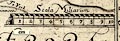
| inscription:- |
printed above scale line, centre right
Scala Miliarum |
|
| scale line:- | 10 miles = 64.1 mm | |
| scale:- | 1 to 250000 ? (1 to 251068 from scale line assuming a statute mile) | |
| inscription:- |
[Comberland and Westmorland Exactly Described by C.S. Corrected & Amended ... by P. Lea.] 1689 and 1693 |
|
| inscription:- |
[Sold by Geo : Willdey at ye Great Toy, Spectacle, Chinaware, and print Shop, the Corner of Ludgate Street near St. Pauls London] 1732 |
|
|
||
| references:- |
Lea, Philip: 1689 (?) & 1693 (?): Shires of England and
Wales described by Christopher Saxton: (London) Lea, Philip: 1693 (?): Atlas Anglois: (London) : 1732: Shires Of England And Wales Described by Christopher Saxton: Willdey, George (London) : 1749: Shires Of England And Wales: Jeffreys, Thomas (London) Lynam, E (author of introduction): 1934 & 1939: Atlas of England and Wales, the Maps of Christopher Saxton engraved 1574-79 (facsimile): British Museum Whitaker, H: 1939: Later Editions of Saxton's Maps: Imago Mundi: 3: pp.72-86 Evans, Ifor M & Lawrence, Heather: 1979: Christopher Saxton, Elizabethan Map-Maker: Wakefield Historical Publications & Holland Press (Wakefield, Yorkshire):: ISBN 0 901869 06 6 |
|
| sources:- |
Chubb 1927 (VIII) Curwen 1918 Skelton 1970 Hodson 1984 Wordsworth Trust Collection Armitt Library JandMN Collection |
|
| items seen (illustrated items in bold):- | ||

|
Armitt Library : ALMC2008.14.1 -- map -- Comberland and Westmorland -- Carlile | |
|
|
Dove Cottage : 2007.38.16 -- map -- Comberland and Westmorland -- Carlile | |
|
|
JandMN (187) -- map -- Comberland and Westmorland -- Carlile | |