 Lea 1689

|

|
|
|
item:- JandMN (187) image:- © see bottom of page |
click to enlarge |
|
|
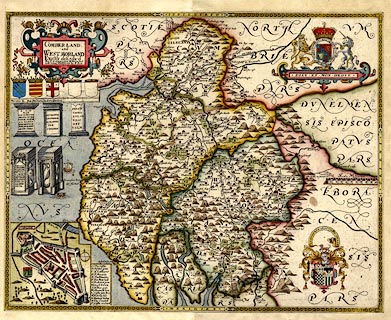
Map, hand coloured engraving, Comberland and Westmorland,
scale about 4 miles to 1 inch, by Christopher Saxton, 1576,
amended by Philip Lea, London, 1689 to 1693.
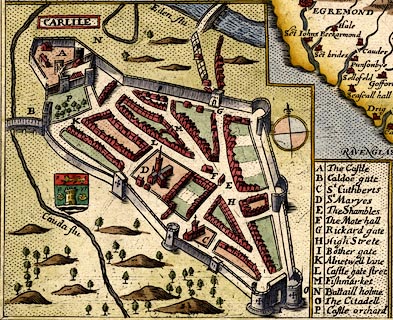
The inset map is of Carlile ie Carlisle, Cumberland, on a larger scale, with a gazetteer of places. |
||

|
Lea 1689 | |
| map feature:- | picture frame border & strapwork cartouche & coat of arms & heraldic border & vignettes (roman antiquities) & labelled borders (Latin) & up is N & scale line & sea stippled & coast shaded & rivers & lakes & relief & hillocks & woods & forests & county & wards (hundreds) & settlements & roads & inset map | |
| inscription:- |
printed title cartouche, upper left
COMBERLAND / and / WESTMORLAND / Exactly described / by CS Corrected & Amended / with many Additions by P. Lea |
|
| inscription:- |
printed above scale line, centre right
Scala Miliarum |
|
| scale line:- | 10 miles = 64.2 mm | |
| wxh, sheet:- | 57.5x48cm | |
| wxh, map:- | 494x391mm | |
| scale:- | 1 to 250000 ? (1 to 250677 from scale line assuming a statute mile) | |
|
||
|
|
notes | |