item:-
JandMN : 187
image:-
©
see bottom of page
LEA5In.jpg
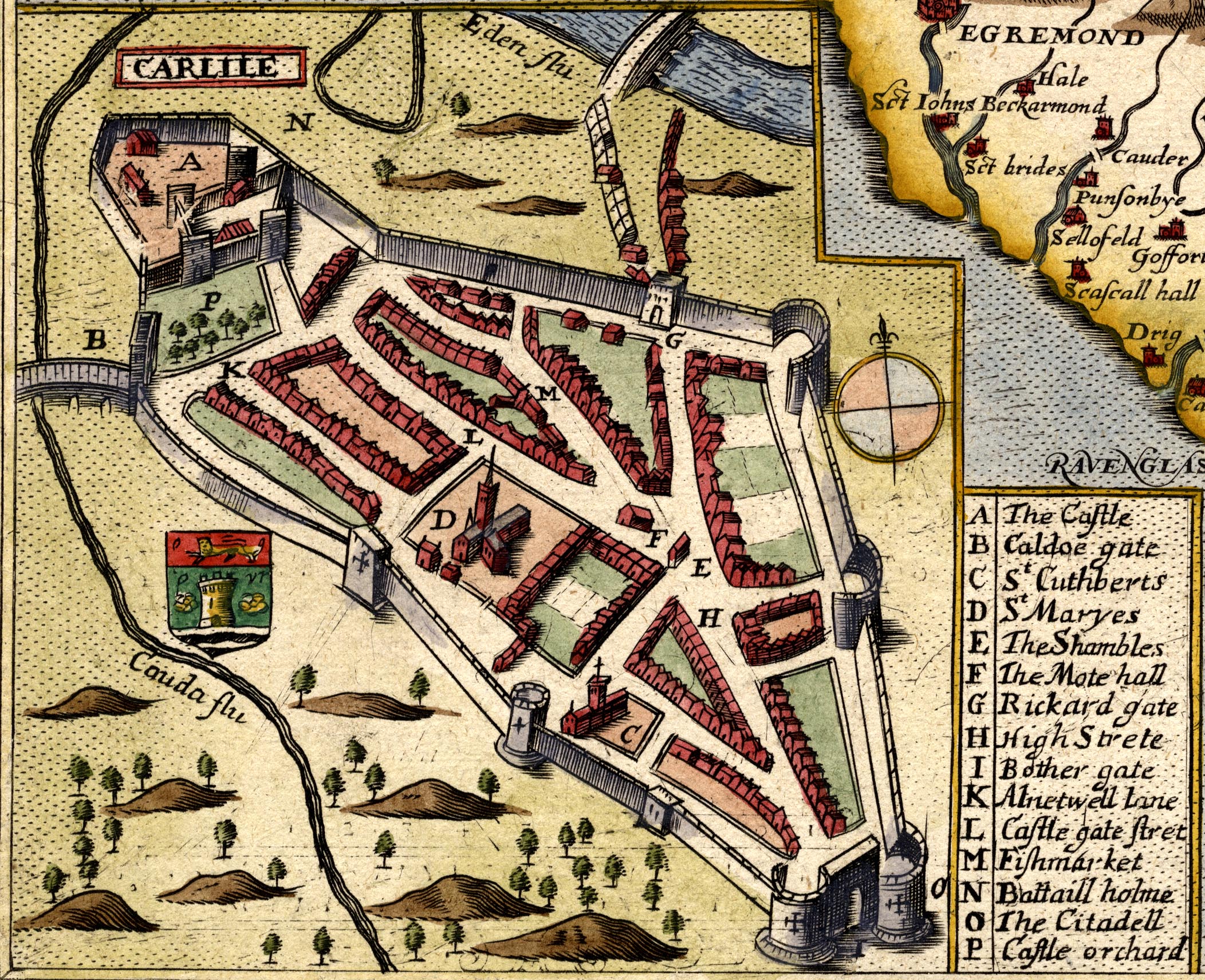
Map, hand coloured engraving, Comberland and Westmorland, scale about 4 miles to 1 inch, by Christopher Saxton, 1576, amended by Philip Lea, London, 1689 to 1693.
Lakes Guides menu.
 Lakes Guides menu.