 Langley 1818

|

|
|
|
map type:- Langley 1818 |
|
|
|
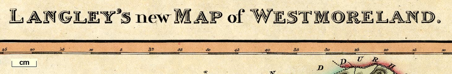
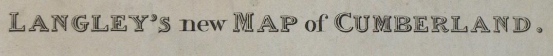
Maps, Langley's New Map of Westmoreland, scale about 6
miles to 1 inch, and Cumberland, scale about 8.5 miles to 1
inch, by Edward Langley, 173 High Street, Borough, London,
1817; published 1818-20.
Published in 'Langley's New County Atlas of England and Wales, embellished with a beautiful vignette to each Map, exhibiting the mail Coach, Turnpike, and Principal Cross Roads. With the Cities, Towns, Villages, Parks, Rivers, & Navigable Canals, Peculiar to each County. Also an Index map of England and Wales, shewing the connection of one County with another. London. Published by Langley & Belch, 173, High Street, Borough,' 1818. The atlas has title page, map of the country and 52 county maps; its size is 7 1/4 x 10 1/4 ins. The Westmorland map has a vignette of Windermere. Published in another edition '... London Published by Joseph Phelps, 27, Paternoster Row,' 1820. |
||
|
(map example Dove Cottage : 2007.38.119)
|
||
| map feature:- | vignettes & compass rose & up is N & scale line & lat and long scales (rectangular projection; West of Greenwich) & sea plain & coast shaded & rivers & lakes & relief & hill hachuring & parks & county & wards (hundreds) & table of wards (hundreds) & settlements & roads | |
| inscription:- |
printed top
LANGLEY'S new MAP of WESTMORELAND. |
|
| inscription:- |
printed bottom
Printed and published by Langley & Belch No.173, High Street, Borough, London, April 1st. 1818. |
|
| inscription:- |
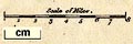
printed above scale line
Scale of Miles. |
|
| wxh, sheet:- | 35x21.5cm | |
| wxh, plate:- | 340x211mm | |
| wxh, map:- | 257x174mm | |
| scale line:- | 8 miles = 33.5 mm | |
| scale:- | 1 to 380000 ? (1 to 384321 from scale line assuming a statute mile) | |
| longitude, Kendal:- | 2d 47.5m W (approx) | |
|
||
| references:- |
Langley, Edward: 1818: Langley's New County Atlas of England
and Wales: Langley and Belch (London) Langley, Edward: 1820: Langley's New County Atlas of England and Wales: Phelps, Joseph (London) |
|
| sources:- |
Chubb 1927 (CCCLIX) Wordsworth Trust Collection Armitt Library Carlisle Library Maps |
|
| items seen (illustrated items in bold):- | ||

|
Armitt Library : ALMC2008.14.83 -- map -- Langley's New Map of Westmoreland -- Westmoreland | |
|
|
Carlisle Library : Map 145 -- map -- Langley's New Map of Cumberland -- Cumberland | |
|
|
Carlisle Library : Map 182 -- map -- Langley's New Map of Westmoreland -- Westmoreland | |
|
|
Dove Cottage : 2007.38.119 -- map -- Langley's New Map of Westmoreland -- Westmoreland | |