 Langley 1818

|

|
|
|
item:- Dove Cottage : 2007.38.119 image:- © see bottom of page |
click to enlarge |
|
|
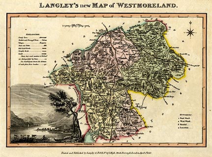
Map, hand coloured engraving, Langley's New Map of
Westmoreland ie Westmorland, scale about 6 miles to 1 inch,
by Edward Langley, published by Langley and Belch, 173 High
Street, Borough, London, 1818.
From Langley's New County Atlas of England and Wales. There is a vignette scene of Windermere lower left. |
||

|
Langley 1818 | |
| map feature:- | vignettes & compass rose & up is N & scale line & lat and long scales (rectangular projection; West of Greenwich) & sea plain & coast shaded & rivers & lakes & relief & hill hachuring & parks & county & wards (hundreds) & table of wards (hundreds) & settlements & roads | |
| inscription:- |
printed top
LANGLEY'S new MAP of WESTMORELAND. |
|
| inscription:- |
printed bottom
Printed and published by Langley & Belch No.173, High Street, Borough, London, April 1st. 1818. |
|
| inscription:- |
printed above scale line
Scale of Miles. |
|
| scale line:- | 8 miles = 33.5 mm | |
| longitude, Kendal:- | 2d 47.5m W (approx) | |
| inscription:- |
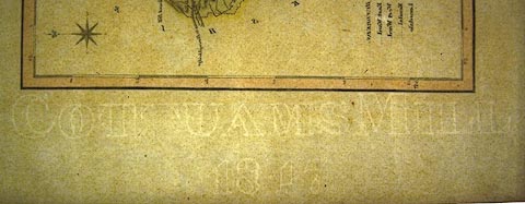
watermark:
COT[T]UAMS MILL / 1817 |
|
| scale:- | 1 to 380000 ? (1 to 384321 from scale line assuming a statute mile) | |
| wxh, sheet:- | 35x21.5cm | |
| wxh, plate:- | 340x211mm | |
| wxh, map:- | 257x174mm | |
|
||