 Geological Map of the Lake District (?)

|

|
|
|
map type:- Thomas 1916 |
|
|
|
Geological Map of the Lake District, scale about 4 miles
to 1 inch, by H H Thomas, about 1916.
Derived from the Ordnance Survey and Geological Survey, included in Geology of the Lake District, by J E Marr, published by Cambridge University Press, Cambridge, Cambridgeshire, 1916. |
||
| see:- | Marr 1916 | |
| map feature:- | up is N & scale line & lat and long scales & sea plain & coast form lines & rivers & lakes & woods & trees & county & settlements & roads & railways & geology | |
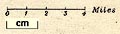
| scale line:- | 4 miles = 25 cm | |
| scale:- | 1 to 260000 ? | |
|
||
| sources:- |
private collection JandMN Collection |
|
| items seen (illustrated items in bold):- | ||

|
JandMN (173_1) -- geological map -- Geological Map of the Lake District | |