 Blome 1673

|

|
|
|
map type:- Blome 1673 |
|
|
|
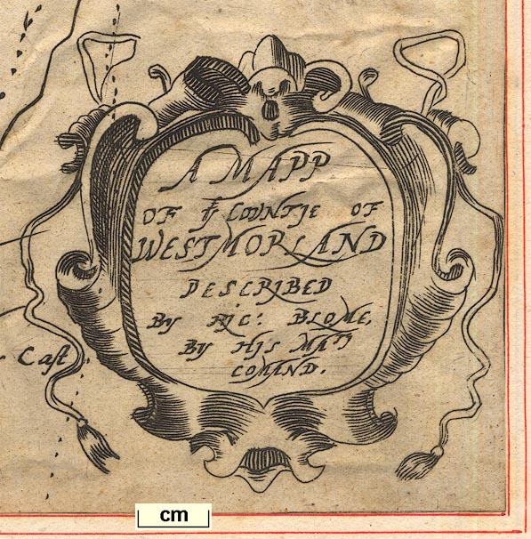
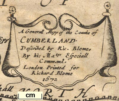
Maps, Mapp of ye Countie of Westmorland, scale about 3
miles to 1 inch, and A Generall Mapp of the Countie of
Cumberland, scale about 4 miles to 1 inch, by Richard Blome,
probably engraved by Richard Palmer, published, London,
1673; published 1673-77.
The Westmorland map has the coat of arms of Sir John Lowther; Cumberland has the arms of Charles Howard Earl of Carlisle. Published in 'Britannia: or, A Geographical Description of the Kingdoms of England, Scotland, and Ireland, with the Isles and Territories thereto belonging. And for The better perfecting the said Work, there is added an Alphabetical Table of the Names, Titles, and Seats of the Nobility and Gentry that each County of England and Wales is, or lately was, enobled with. Illustrated with a Map of each County of England, besides several General ones. The like never before Published. London, Printed by Tho. Roycroft for the Undertaker, Richard Blome. MDCLXXIII.' ie 1673. The series of maps were engraved from 1669-1673. Various prospectuses suggest publication dates 1670 and 1671 but the atlas seems finally to have been published 1673. The atlas size is 5 1/2 x 10 3/4 ins; the maps are poorly drawn and engraved. Blome was 'a published and compiler of some celebrity, who, by the aid of subscriptions adroitly levied, issued many splendid works' but he was not regarded highly by his contemporaries. He 'scribbled and transcribed from Camden's Britannia and Speed's Maps ... gets a livelihood by bold practices ... progging tricks in employing necessitous persons to write ...'. Bishop William Nicolson, 1696, described Blome's Britannia as a 'most entire piece of theft out of Camden and Speed.' Richard Gough said it was a 'most notorious piece of plagiarism.' Published in 'Britannia: or, A Geographical Description of the Kingdoms of England, Scotland, and Ireland, with the Isles and Territories thereunto belonging. ... London, Printed for John Wright at the Crown on Ludgate-Hill. MDCLXXVII.' ie 1677. The 1677 edition is perhaps made up of remainder sheets acquired from Blome, with a title page by Wright. |
||
|
(map example GRMDC: )
|
||
| map feature:- | labelled borders & title cartouche & scroll cartouche & up is N & scale line & sea plain & coast shaded & rivers & lakes & relief & hillocks & parks & county & settlements | |
| inscription:- |
printed title cartouche, lower right
A MAPP / OF YE COUNTYE OF / WESTMORLAND / DESCRIBED / BY RIC : BLOME / BY HIS MATY / COMAND |
|
| inscription:- |
printed drape cartouche, upper left; coat of arms
To The Honeble Sr. John / Lowther Seinour of / Lowther Hall Bart, / This Mapp is Humbly / Dedicated by Ric : Blome. |
|
| wxh, map:- | 247x316mm | |
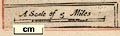
| scale line:- | 6 miles = 49.0 mm | |
| scale:- | 1 to 200000 ? (1 to 197063 from scale line) | |
|
||
|
||
| references:- |
Blome, Richard: 1673: Britannia & Geographical Description
of the Kingdoms of England, Scotland, and Ireland ...:
(London) Blome, Richard: 1677: Britannia & Geographical Description of the Kingdoms of England, Scotland, and Ireland ...: Wright, John (London) Taylor, E G R: 1937: Robert Hooke and the Cartographical Projects of the Late Seventeenth Century, 1666-1696: Geographical Journal: 90: pp.529-40 Kennedy, C: 1958: Gentleman's Recreation, by Richard Blome: (London) |
|
| sources:- |
Chubb 1927 (XCIX) Skelton 1970 Penrith Museum Collection Wordsworth Trust Collection Armitt Library Kendal Record Office Kendal Library Maps Carlisle Library Maps Curwen 1918 private collection |
|
| items seen (illustrated items in bold):- | ||

|
Armitt Library : ALMC2008.14.37 -- map -- Mapp of ye Countie of Westmorland | |
|
|
Carlisle Library : Map 137 -- map -- Generall Mapp of the Countie of Cumberland | |
|
|
Carlisle Library : Map 258 -- map -- Mapp of ye Countie of Westmorland | |
|
|
Carlisle Library : Map 350 -- map -- Mapp of ye Countie of Westmorland | |
|
|
Dove Cottage : 2007.38.120 -- map -- Mapp of ye Countie of Westmorland | |
|
|
Dove Cottage : 2007.38.121 -- map -- Mapp of ye Countie of Westmorland | |
|
|
Dove Cottage : Lowther.3 -- map -- Mapp of ye Countie of Westmorland | |
|
|
Dove Cottage : Lowther.38 -- map -- Generall Mapp of the Countie of Cumberland | |
|
|
Kendal Library : Map 73 -- map -- Mapp of ye Countie of Westmorland | |
|
|
Kendal Library : Map 74 -- map -- Mapp of ye Countie of Westmorland | |
|
|
KendalRO : WDX 1001 -- map -- Mapp of ye Countie of Westmorland | |
|
|
private collection (168) -- map -- Mapp of York Shire | |
|
|
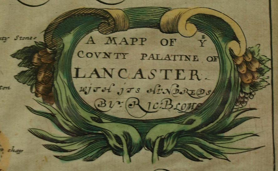
private collection (250) -- map -- Mapp of ye County Palatine of Lancaster | |