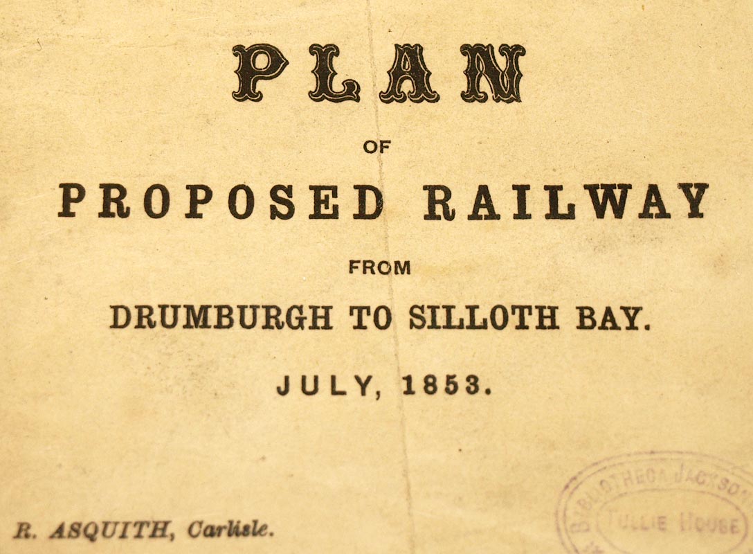
 Plan of proposed Railway from Drumburgh to Silloth
Bay
Plan of proposed Railway from Drumburgh to Silloth
Bay

|

|
|
|
map type:- Asquith 1853 |
|
|
|
Railway map, Plan of proposed Railway from Drumburgh to
Silloth Bay, scale about 1 mile to 1 inch, by R Asquith,
printed by Hudson Scott, Carlisle, Cumberland, 1853.
|
||
|
(example Carlisle Library (36))
|
||
| inscription:- |
printed lower left
PLAN / OF / PROPOSED RAILWAY / FROM / DRUMBURGH TO SILLOTH BAY. / JULY 1853. / R. ASQUITH, Carlisle. |
|
| inscription:- |
printed lower right
Hudson Scott, Engraver and Lithographer, Carlisle. |
|
| wxh, map:- | 400x263mm | |
| inscription:- |
printed with scale line
MILES |
|
| scale line:- | 4 miles = 101.6 mm | |
| scale:- | 1 to 63000 ? (1 to 63360 from scale line, assuming a statute mile) | |
| sources:- |
Carlisle Library Maps |
|
| items seen (illustrated items in bold):- | ||

|
Carlisle Library : Map 86 -- railway map -- Plan of Proposed Railway from Drumburgh to Silloth Bay | |
|
|
Carlisle Library : Map 87 -- railway map -- Plan of Proposed Railway from Drumburgh to Silloth Bay | |