 Map of the English Lake District

|

|
|
|
map type:- Wyld 1847 |
|
|
|
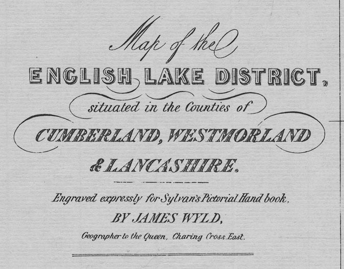
Map of the English Lake District, scale about 3 miles to
1 inch, engraved by James Wyld, Charing Cross East, London,
published by T Johnstone, Edinburgh, Lothian, 1847.
Included in Sylvan's Pictorial Handbook to the English Lakes, published by John Johnstone, Paternoster Row, London, T Johnstone, Edinburgh, D Bryce, Glasgow, and J M'Glashan, Dublin, 1847. And four area maps tipped in through the text - Windermere, Rydal, Grasmere, Esthwaite and Coniston Waters; Thirlmere, Derwentwater, and Bassenthwaite Lakes; Loweswater, Crummock, Buttermere, Ennerdale and Wastwaters; Ulleswater and Hawes Water. |
||
| inscription:- |
printed lower left
Map of the / ENGLISH LAKE DISTRICT, / situated in the Counties of / CUMBERLAND, WESTMORLAND / & LANCASHIRE. / E bgraved expressly for Sylvan's Pictorial Hand book, / BY JAMES WYLD, / Geographer to the Queen, Charing CRoss East. |
|
| inscription:- |
printed bottom
London : Published by T. Johnstone, Paternoster Row & Edinburgh |
|
| scale line:- | 10 miles = 84 mm (on the facsimile) | |
| scale:- | 1 to 190000 ? (from the facsimile scale line) | |
| wxh, map:- | 38.5x53cm (facsimile) | |

|
||
|
||
| references:- |
: 1974: Sylvan's Pictorial Handbook to the English Lakes:
Evans and Longley Associates (Dewsbuy, Yorkshire):: ISBN 0
094293 02 5; facsimile |
|
| sources:- |
Armitt Library |
|
| items seen (illustrated items in bold):- | ||

|
Armitt Library : A1201.64 -- map -- Windermere, Rydal, Grasmere, Esthwaite and Coniston Waters | |
|
|
Armitt Library : A1201.65 -- map -- Thirlmere, Derwentwater, and Bassenthwaite Lakes | |
|
|
Armitt Library : A1201.66 -- map -- Loweswater, Crummock, Buttermere, Ennerdale and Wastwaters | |
|
|
Armitt Library : A1201.67 -- map -- Ulleswater and Hawes Water | |