 New and Correct Map of the Lakes of Cumberland,
Westmoreland, and Lancashire
New and Correct Map of the Lakes of Cumberland,
Westmoreland, and Lancashire

|

|
|
|
map type:- Allison 1834 map |
|
|
|
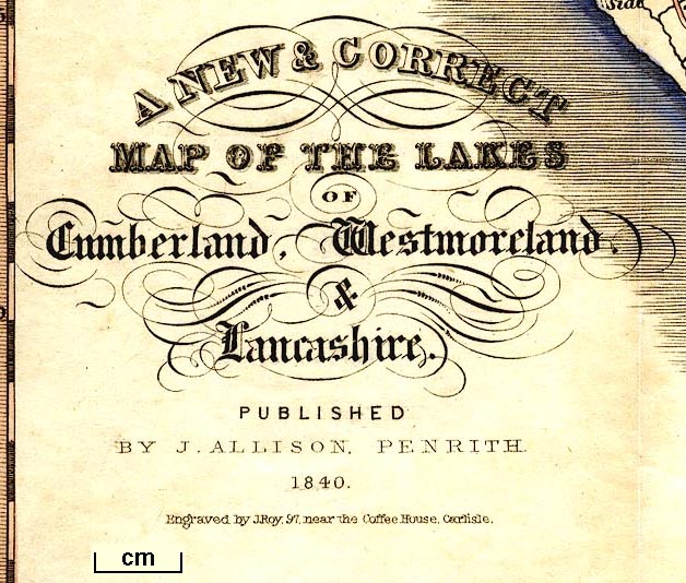
A New and Correct Map of the Lakes of Cumberland,
Westmoreland, and Lancashire, scale about 4 miles to 1 inch,
engraved by J Roy, Carlisle, published by J Allison,
Penrith, Cumberland, 1839.
Frontispiece to Allison's Northern Tourist's Guide to the Lakes, 8th edn 1839. |
||
|
(example Armitt Library : A1100)
|
||
| map feature:- | folded (3x2) & decorative border & compass rose & up is N & scale line & lat and long scales (trapezoidal projection; Longitude West from Greenwich) & sea plain & coast shaded & rivers & lakes & relief & hill hachuring & hillocks (drawings of larger mountains) & spot heights & forests & parks & county & settlements & roads | |
| inscription:- |
printed lower left
A NEW & CORRECT / MAP OF THE LAKES / OF / Cumberland, Westmoreland, / & / Lancashire. / PUBLISHED / BY J. ALLISON, PENRITH / 1840. / Engraved by J. Roy, 97, near the Coffee House, Carlisle. |
|
| wxh, sheet:- | 26.5x33cm | |
| wxh, map:- | 242x292mm | |
| inscription:- |
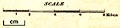
printed with the scale line
SCALE / Miles |
|
| scale line:- | 8 miles = 48.4 mm | |
| scale:- | 1 to 270000 ? (1 to 266007 from scale line) | |
|
||
| sources:- |
Armitt Library |
|
| items seen (illustrated items in bold):- | ||

|
Armitt Library : A1100.1 -- map -- New and Correct Map of the Lakes of Cumberland, Westmoreland, and Lancashire | |