 Map of the English Lakes

|

|
|
|
map type:- Nelson 1880s |
|
|
|
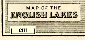
Map of the English Lakes, published by Thomas Nelson and
Sons, London, 1880s?
The included railways suggest a date in the 1880s. Included in an edition of Views of the English Lakes, and Tourists Guide to the English Lakes. |
||
|
(example JandMN (474_2))
|
||
| map feature:- | plain cartouche & up is N & sea shaded & coast line & rivers & lakes & relief & hill hachuring & spot heights & county & settlements & roads & railways | |
| inscription:- |
printed plain cartouche, lower left
MAP OF THE / ENGLISH LAKES |
|
| wxh, page:- | 9.5x14cm | |
| wxh, image:- | 85x126mm | |
| sources:- |
JandMN Collection |
|
| items seen (illustrated items in bold):- | ||

|
JandMN (474_2) -- map -- Map of the English Lakes | |