 Dawson 1830s

|

|
|
|
map type:- Dawson 1830s |
|
|
|
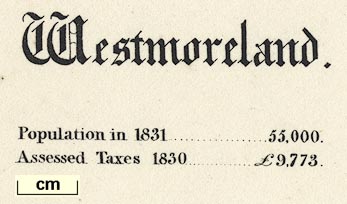
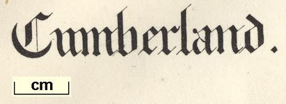
Political maps, Westmoreland, scale about 4 miles to 1
inch, and Cumberland, scale about 7.5 miles to 1 inch,
showing the proposed parliamentary divisions, and town maps
Carlisle, Kendal, Cockermouth, Whitehaven, Workington, at
larger scales, made for the Reform Bill 1832, by Lieut
Robert K Dawson RE, 1831.
Published in 'Plans of the Cities and Boroughs of England and Wales: shewing their boundaries as established by the Boundaries' Act, passed 11th July 1832: together with Outline Maps, shewing, the divisions of counties, the principal places of election, and the polling places, as established by the same Act. In two volumes. London: Printed by James & Luke G. Hansard & Sons, near Lincoln's Inn Fields, 1832.' Printed by lithography; an early use of the process in England. The maps were the byproduct of the Reform Bill 1831, and relate to the Boundaries Act 1832. |
||
|
(map example (private collection (22))
|
||
| map feature:- | county & wards (hundreds) & roads & settlements & scale line & north point & table of symbols & electoral data | |
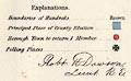
| inscription:- |
printed upper left
Westmoreland. engish black letter |
|
| inscription:- |
printed ms lower right
Robt. K. Dawson, / Lieut. R.E. |
|
| inscription:- |
printed lower left, below scale line
R. Martin, lithog. 124, High Holborn & 51, Carey St. |
|
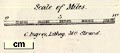
| scale line:- | 8 miles = 49.6 mm | |
| scale:- | 1 to 260000 ? (1 to 259572 from scale line) | |
| wxh, sheet:- | 36x34cm | |
|
||
|
||
|
||
| references:- |
Dawson, Robert K: 1832: Plans of the Cities and Boroughs of
England and Wales: Hansard (London) |
|
| sources:- |
Chubb 1927 (CCCCXXXIX) JandMN Collection private collection Wordsworth Trust Collection Carlisle Library Maps Kendal Library Maps |
|
| items seen (illustrated items in bold):- | ||

|
Carlisle Library : Map 36 -- map -- Cumberland | |
|
|
Carlisle Library : Map 37 -- map -- Cumberland | |
|
|
Carlisle Library : Map 112 -- map -- Carlisle | |
|
|
Carlisle Library : Map 126 -- map -- Cockermouth | |
|
|
Carlisle Library : Map 133 -- map -- Whitehaven and Workington | |
|
|
Carlisle Library : Map 233 -- street map -- Carlisle | |
|
|
Dove Cottage : 2009.81.1 -- map -- Carlisle | |
|
|
Dove Cottage : 2009.81.5 -- map -- Cumberland | |
|
|
JandMN (213) -- map -- Cumberland | |
|
|
JandMN (214) -- map -- Westmoreland | |
|
|
JandMN (219) -- map -- Carlisle | |
|
|
Kendal Library : Map 111 -- map -- Kirkby Kendal | |
|
|
Kendal Library : Map 112 -- map -- Westmoreland | |
|
|
Kendal Library : Map 162 -- map -- Westmoreland | |
|
|
Kendal Library : Map 163 -- map -- Kirkby Kendal -- Report on the Borough of Kendal | |