 Map of the Roads of England and Wales

|

|
|
|
map type:- Jefferys 1760s |
|
|
|
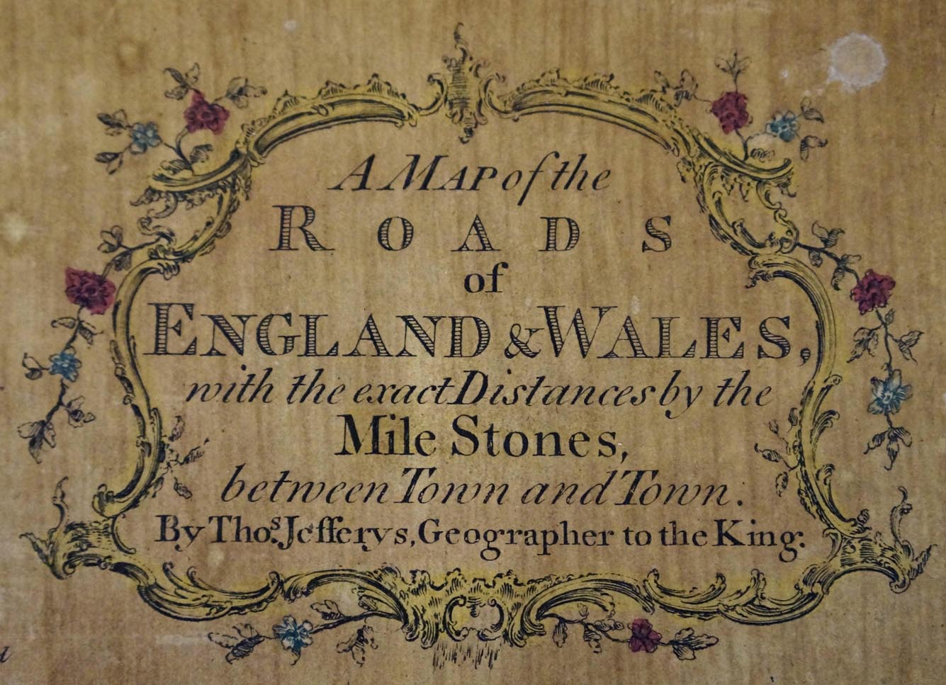
Jigsaw puzzle map, A Map of the Roads of England and
Wales, scale about 25 miles to 1 inch, by Thomas Jefferys,
published by Francis Newberry, 20 Ludgate Street, London,
late 18th century.
|
||
|
(example private collection (309))
|
||
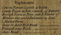
| map feature:- | title cartouche & floral cartouche & up is N & scale line & lat and long scales & sea plain & coast shaded & rivers & lakes (few) & relief & hillocks ( a few) & county & settlements & roads | |
| inscription:- |
printed upper right, floral cartouche
A Map of the / ROADS / of / ENGLAND & WALES / with the exact distances by the / Mile Stones, / between Town and Town. / By Thos. Jefferys, Geographer to the King. |
|
| inscription:- |
printed bottom
London. P[rinted for Francis Newberry No.20] Ludgate Street |
|
| wxh, sheet:- | 37.5x44.5cm | |
| wxh, map:- | 371x438mm | |
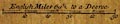
| inscription:- |
printed with scale line
English Miles 69 1/2 to a Degree |
|
| scale line:- | 50 miles = 49.9 mm | |
| scale:- | 1 to 1600000 ? (1 to 1612569 from scale line) | |
|
||
|
||
| items seen (illustrated items in bold):- | ||

|
private collection (309) -- jigsaw puzzle map -- Map of the Roads of England and Wales | |