 Commercial and Library Atlas of the British Isles from the
Ordnance Survey
Commercial and Library Atlas of the British Isles from the
Ordnance Survey

|

|
|
|
map type:- Bacon 1895 |
|
|
|
Maps, The Commercial and Library Atlas of the British
Isles from the Ordnance Survey, published by G W Bacon and
Co, Strand, London, 1895.
Plates in this atlas begin their life in the Dispatch Atlas, maps by Edward Weller, issued with the Weekly Dispatch newspaper from 1856-62. They are reproduced by lithographic transfers at different scales up to as late as the 1930s, new maps being added to the series from time to time (see Smith 1985). G W Bacon used the plates in the Commercial atlas in 1895. |
||

|
||
|
||
| sources:- |
Smith 1985 JandMN Collection |
|
| items seen (illustrated items in bold):- | ||

|
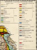
JandMN (423) -- geological map -- Geological Map of England and Wales -- Geological England North Sheet | |