 Baddeley 1930s map

|

|
|
|
map type:- Baddeley 1930s map |
|
|
|
Maps, The Lake District, and other maps, by John
Bartholomew and Co, Edinburgh, published by Ward, Lock and
Co, Warwick House, Salisbury Square, London, 1930s.
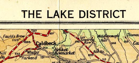
Included in Baddeleys' Guide to the English Lake District. While the maps do not exactly match the 1930s Bartholomews sheet of The Lakes, the style and content are entirely familiar. |
||
|
(example JandMN (305_4))
|
||
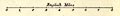
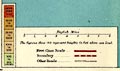
| map feature:- | folded (4x3) & table of symbols & up is N & scale line & sea tinted & coast line & rivers & lakes & relief & contours & layer colouring & table of heights & spot heights & forests & settlements & roads & railways & canals | |
| inscription:- |
printed top
THE LAKE DISTRICT |
|
| inscription:- |
printed bottom left, right, centre
Copyright / John Bartholomew & Son, Ltd, Edinburgh / WARD, LOCK, & CO., Warwick House, Salisbury Square, LONDON. |
|
| wxh, sheet:- | 35x34.5cm | |
| wxh, image:- | 339323mm | |
|
||
|
||
| sources:- |
JandMN Collection |
|
| items seen (illustrated items in bold):- | ||

|
JandMN (305_4) -- map -- Lake District | |