 Duncan 1833

|

|
|
|
map type:- Duncan 1833 |
|
|
|
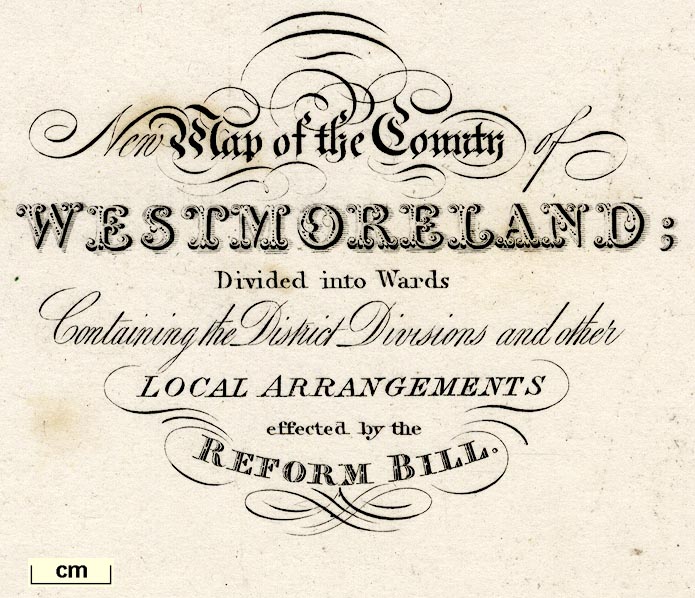
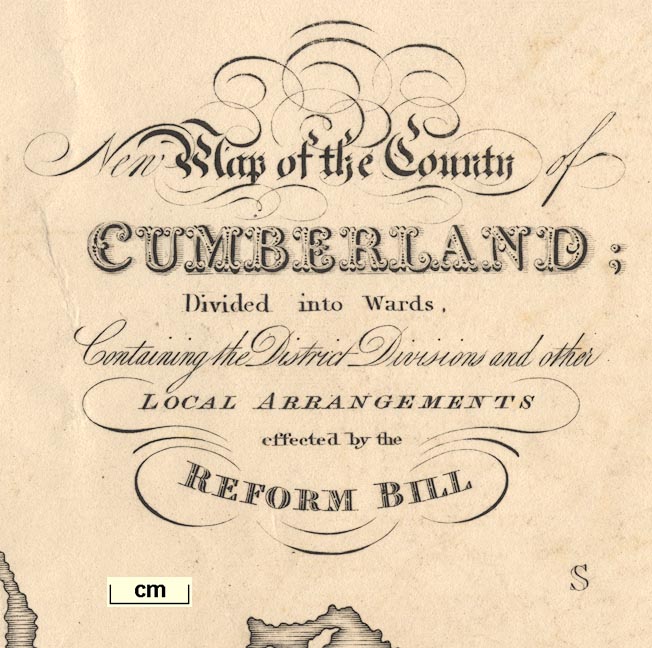
Maps, New Map of the County of Westmoreland, scale about
3 miles to 1 inch, and New Map of the County of Cumberland,
scale about 4 miles to 1 inch, by William Ebden, engraved by
Hoare and Reeves, published by James Duncan, Paternoster
Row, London, 1833; published 1833-45.
Published in 'A Complete County Atlas of England & Wales, containing Forty four superior maps. With all the improvements - projected or completed. Divided into Hundreds, With the District Divisions, and other Local Arrangements effected by the Reform Bill. London: Published by James Duncan, Paternoster Row.' 1833. The maps were altered from Ebden's originals by James Duncan to show the arrangements since the Reform Act, 1832. Published earlier by William Cole, London, 1825 as a loose sheet. Maps in the series are sometimes titled Hodgson's ..., an earlier publisher, or Ebden's ... Published in another edition 1840; and perhaps again 1845. |
||
|
(example map)
|
||
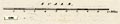
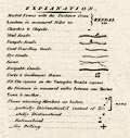
| map feature:- | table of symbols & compass rose & up is N & scale line & sea plain & coast shaded & rivers & lakes & relief & hill hachuring & woods & trees & forests & parks & county & electoral data & settlements & roads | |
| inscription:- |
printed upper left
New Map of the County of / CUMBERLAND; / Divided into Wards, / Containing the District Divisions and other / LOCAL ARRANGEMENTS / effected by the / REFORM BILL |
|
| inscription:- |
printed bottom
[London Published by] J. Duncan. Paternoster Row |
|
| wxh, sheet:- | 39.5x49cm | |
| wxh, map:- | 350x439mm | |
| scale line:- | 10 miles = 59.1 mm | |
| scale:- | 1 to 270000 ? (1 to 272309 from scale line) | |
|
||
|
||
|
||
| references:- |
Duncan, James: 1833 & 1840 & 1845: Complete County Atlas of
England and Wales & New Atlas of England and Wales (and
other titles?): Duncan, James (Paternoster Row, London) Smith, David: 1991: Early Issues of William Ebden's English County Maps: Imago Mundi: vol.43: pp.48-58 |
|
| sources:- |
Chubb 1927 (CCCCLV) private collection Armitt Library Carlisle Library Maps |
|
| items seen (illustrated items in bold):- | ||

|
Armitt Library : ALMC2008.14.53 -- map -- New Map of the County of Westmoreland | |
|
|
Carlisle Library : Map 152 -- map -- New Map of the County of Cumberland | |
|
|
Carlisle Library : Map 193 -- map -- Map of the County of Westmoreland | |
|
|
private collection (70) -- map -- New Map of the County of Cumberland | |