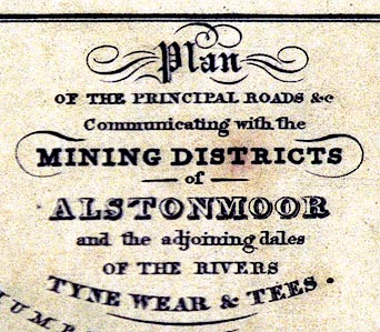
 Plan of the Principal Roads Communicating with the Mining
Districts of Alstonmoor ...
Plan of the Principal Roads Communicating with the Mining
Districts of Alstonmoor ...

|

|
|
|
map type:- Sopwith 1833 |
|
|
|
Road map, Plan of the Principal Roads Communicating with
the Mining Districts of Alstonmoor, ..., Cumberland, scale
about 12.5 miles to 1 inch, by T Sopwith, engraved by W
Collard, published by W Davison, Alnwick, Durham, 1833.
Frontispiece to An Account of the Mining Districts of Alston Moor, Weardal and Teesdale in Cumberland and Durham. |
||
| inscription:- |
printed upper right
Plan / OF THE PRINCIPAL ROADS &c. / Communicating with the / MINING DISTRICTS / of / ALSTONMOOR / and the adjoining dales / OF THE RIVERS / TYNE WEAR & TEES. |
|
| inscription:- |
printed bottom right
W. CollardSculpt. |
|
| wxh, sheet:- | 11x17.5cm | |
| wxh, map:- | 93x139mm | |
| scale line:- | 20 miles = 41.2 mm | |
| scale:- | 1 to 780000 ? (1 to 781235 from scale line assuming a statute mile) | |

|
||
| sources:- |
Kendal Library Maps |
|
| items seen (illustrated items in bold):- | ||

|
Kendal Library (11_1) -- map -- Plan of the Principal Roads Communicating with the Mining Districts of Alstonmoor ... | |