button to main menu Sopwith 1833

item:-
Kendal Library (11_1)
image:-
©  see bottom of page
image, button to large image
click to enlarge


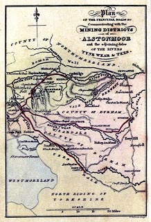
Map, hand coloured engraving, Plan of the Principal Roads Communicating with the Mining Districts of Alstonmoor, ..., scale about 12.5 miles to 1 inch, by T Sopwith, engraved by W Collard, published by W Davison, Alnwick, Durham, 1833.
Frontispiece to An Account of the Mining Districts of Alston Moor, Weardal and Teesdale in Cumberland and Durham.
   Sopwith 1833
map feature:- north point & up is N & scale line & rivers & relief & hill hachuring & county & settlements & roads
inscription:- printed upper right
Plan / OF THE PRINCIPAL ROADS &c. / Communicating with the / MINING DISTRICTS / of / ALSTONMOOR / and the adjoining dales / OF THE RIVERS / TYNE WEAR & TEES.
inscription:- printed bottom right
W. CollardSculpt.
scale line:- 20 miles = 41.2 mm
wxh, sheet:- 11x17.5cm
wxh, map:- 93x139mm
scale:- 1 to 780000 ? (1 to 781235 from scale line assuming a statute mile)