 Murray 1830

|

|
|
|
map type:- Murray 1830 |
|
|
|
Maps, Westmorland, scale about 3 miles to 1 inch, and
Cumberland, scale about 4.5 miles to 1 inch, by T L Murray
by order of the Board of Ordnance, engraved by Hoare and
Reeves, London, 1831.
Published in 'An Atlas of the English Counties divided into Hundreds &c., containing the Rivers, Roads, Parks, Parishes, &c. in each, Exhibiting the whole of the Inland Navigation, Rail Roads, &c., And accompanied by Maps of England, Ireland, Scotland and Wales, Projected on the basis of the Trigonometrical Survey By Order of the Honble. The Board of Ordnance. Under the Superintendence of T. L. Murray.' 1830. Published in another edition 1831. |
||
|
(example map)
|
||
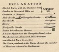
| map feature:- | table of symbols & compass rose & up is N & scale line & lat and long scales & coast shaded & rivers & lakes & relief & hill hachuring & forests & parks & county & wards (hundreds) & table of wards (hundreds) & settlements & roads & canals | |
| inscription:- |
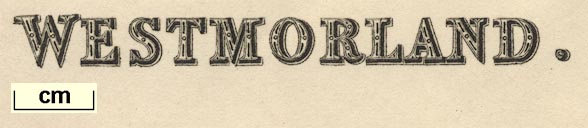
printed upper left
WESTMORLAND |
|
| inscription:- |
printed bottom left, centre, and right
Drawn under the Superintendance of T. L. Murray / London. Published May 1st. 1831, by T. L. Murray, 19, Adam Street, Adelphi. / Hoare & Reeves Sculpt. |
|
| wxh, sheet:- | 48x38cm | |
| wxh, map:- | 450x355mm | |
| scale line:- | 10 miles = 80.9 mm | |
| scale:- | 1 to 200000 ? (1 to 198930 from scale line) | |
|
||
|
||
| references:- |
Murray, T L: 1830: Atlas of the English Counties |
|
| sources:- |
Chubb 1927 (CCCCXIX) private collection JandMN Collection Armitt Library Carlisle Library Maps Kendal Library Maps |
|
| items seen (illustrated items in bold):- | ||

|
Armitt Library : ALMC2008.14.59 -- map -- Westmorland | |
|
|
Carlisle Library : Map 148 -- map -- Cumberland | |
|
|
Carlisle Library : Map 187 -- map -- Westmorland | |
|
|
JandMN (121) -- map -- Westmorland | |
|
|
JandMN (439) -- map -- Yorkshire | |
|
|
Kendal Library : Map 88 -- map -- Westmorland | |
|
|
Kendal Library : Map 89 -- map -- Westmorland | |