 Murray 1830

|

|
|
|
item:- Armitt Library : ALMC2008.14.59 image:- © see bottom of page |
click to enlarge |
|
|
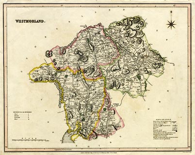
Map, hand coloured engraving, Westmorland, scale about 3
miles to 1 inch, by T L Murray, engraved by Hoare and
Reeves, published by T L Murray, 19 Adam Street, Adelphi,
London, 1831.
|
||

|
Murray 1830 | |
| map feature:- | table of symbols & compass rose & up is N & scale line & lat and long scales & coast shaded & rivers & lakes & relief & hill hachuring & forests & parks & county & wards & table of wards & settlements & roads & canals | |
| inscription:- |
printed upper left
WESTMORLAND. |
|
| inscription:- |
printed bottom left, centre, and right
Drawn under the Superintendance of T. L. Murray / London. Published May 1st. 1830, by T. L. Murray, 19, Adam Street, Adelphi. / Hoare & Reeves Sculpt. |
|
| scale line:- | 10 miles = 81.5 mm | |
| scale:- | 1 to 200000 ? (1 to 197466 from scale line) | |
| wxh, sheet:- | 48x38.5cm | |
| wxh, map:- | 454x357mm | |