 Border, The

|

|
|
|
map type:- OS 1934 Quarter Inch |
|
|
|
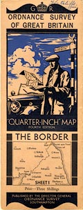
Map series, Quarter Inch Map of Great Britain, 4th edn
with 10000 yard grid, scale 4 miles to 1 inch, published by
the Ordnance Survey, Southampton, Hampshire 1934-35.
The sheets for Westmorland, Cumberland etc are:- sheet 1 - The Border (which is also sheet 1 of the Scottish series) sheet 2 - North Central sheet 3 - England, North East sheet 2 - Scotland, SW, overlaps sheet 1 and includes a little of Cumberland. The index grid is described as the National Grid but is a forerunner of what is now the National Grid, and is in 10000 yard squares (cf 10Km squares). |
||
|
||
| sources:- |
JandMN Collection Hellyer 1999 |
|
| items seen (illustrated items in bold):- | ||

|
JandMN (436_1) -- map -- Border, The | |
|
|
JandMN (436_2S) -- map -- Scotland, SW | |
|
|
JandMN (436_2) -- map -- North Central | |
|
|
JandMN (436_3) -- map -- England, North East | |