 Lake District

|

|
|
|
map type:- Bartholomew 1870s |
|
|
|
Map, The Lake District, scale about 4 miles to 1 inch, by
J Bartholomew, Edinburgh, published by Simpkin, Marshall and
Co, Stationers' Hall Court, London and J Heywood, Deansgate,
Manchester, 1870s?
Included in The English Lakes, How to See Them for Five and a Half Guineas, by John Bradbury, with a red line overprint showing the route described in the guide book. |
||
|
(example Armitt Library : A1124.1)
|
||
| map feature:- | folded (2x4) & up is N & lat and long grid (perhaps) & sea plain & depth contours & sandbanks & coast line & foreshore sands & rivers & lakes & relief & hill hachuring & spot heights | |
| inscription:- |
printed lower left
THE LAKE DISTRICT. |
|
| inscription:- |
printed bottom right
J. Bartholomew, Edinr. |
|
| wxh, sheet:- | 29x37.5 | |
| wxh, map:- | 257x345mm | |
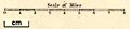
| inscription:- |
printed with scale line
Scale of Miles. |
|
| scale line:- | 8 miles = 49.4 mm | |
| scale:- | 1 to 260000 ? (1 to 260623 from scale line) | |
|
||
| sources:- |
Armitt Library |
|
| items seen (illustrated items in bold):- | ||

|
Armitt Library : A1124.1 -- map -- Lake District | |