 Wallis 1812

|

|
|
|
map type:- Wallis 1812 |
|
|
|
Maps, Westmoreland, scale about 6 miles to 1 inch, and
Cumberland, scale about 8 miles to 1 inch, by James Wallis,
London, 1812.
Published in 'A New and Improved County Atlas. Wallis's New British Atlas containing a complete set of County Maps divided into Hundreds in which are carefully delineated all the Direct and Cross Roads, Cities, towns, Villages, Parks, Seats, Rivers, and Navigable Canals, and a general Map of England and Wales. The whole engraved in the most accurate manner from the latest actual surveys. London: Published by J. Wallis, 1812.' The atlas size is 10 1/2 x 16 ins. Published in another edition '... Published by S. A. Oddy, 1812.' probably 1813. The atlas size is 6 1/2 x 10 ins. Published as a 'Second Edition with Considerable Improvements & Additions by G. Herbert, Geographer', 'London, Published by J. Wallis 1814'. One '... Improvement ...' on the 2nd edition is the addition of a meridian, labelled 'Meridian of London', at 0 degrees. As this is really the 2 degree West meridian the label is a bad mistake. Published in '[Ellis's New and Correct Atlas of England and Wales; being an entire New Set of County Maps ... London, 1819]'. The erroneous meridian has have been removed. |
||
|
(map example private collection (43))
|
||
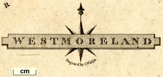
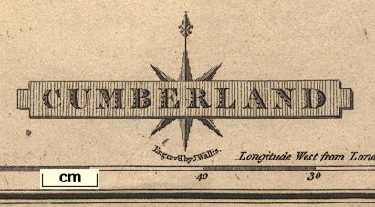
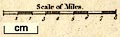
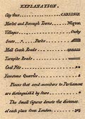
| map feature:- | title cartouche & compass rose & up is N & scale line & lat and long scales & sea plain & coast shaded & rivers & lakes & relief & hill hachuring & parks & county & wards (hundreds) & table of wards (hundreds) & settlements & roads & canals | |
| inscription:- |
printed title cartouche, lower right
CUMBERLAND / Engrav'd by J. Wallis. |
|
| wxh, sheet:- | 19x27cm | |
| wxh, map:- | 176x262mm | |
| scale line:- | 12 miles = 37.9 mm | |
| scale:- | 1 to 510000 ? (1 to 509555 from scale line) | |
|
||
|
||
|
||
| references:- |
Wallis, James: 1812: New and Improved County Atlas &
Wallis's New British Atlas: (London) Wallis, James: 1812: Wallis's New British Atlas: Oddy, S A (London) Ellis: 1819: Ellis's New and Correct Atlas of England and Wales: Ellis (London) |
|
| sources:- |
Chubb 1927 (CCCXLIX) Chubb 1927 (CCCLXVII) Wordsworth Trust Collection Armitt Library Kendal Library Maps |
|
| items seen (illustrated items in bold):- | ||

|
Armitt Library : ALMC2008.14.109 -- map -- Westmoreland | |
|
|
Armitt Library : ALMC2008.14.110 -- map -- Westmoreland | |
|
|
Dove Cottage : 2007.38.39 -- map -- Westmoreland | |
|
|
Dove Cottage : 2009.81.18 -- map -- Cumberland | |
|
|
Kendal Library : Map 10 -- map -- Westmoreland | |