 Map of the Lakes of England

|

|
|
|
map type:- Tattersall 1836 map |
|
|
|
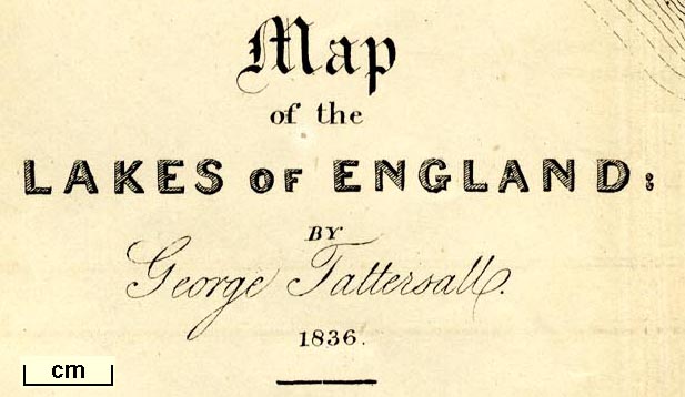
Map of the Lakes of England, scale about 4 miles to 1
inch, by George Tattersall, engraved by J Nethercliff, 23
King William Street, Strand, published by Sherwood and Co,
23 Paternoster Row, London, about 1836.
Included in The Lakes of England, by George Tattersall |
||
|
(example Armitt Library : A1204.2)
|
||
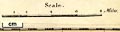
| map feature:- | folded (3x2) & up is N & scale line & lat and long scales (rectangular projection; Longitude West from Greenwich) & sea plain & coast form lines & rivers & lakes & relief & hill hachuring & forests & parks & county & settlements & roads & sands roads & canals | |
| inscription:- |
printed lower left
Map / of the / LAKES OF ENGLAND : / BY / George Tattersall. / 1836. |
|
| wxh, sheet:- | 26.5x33cm | |
| wxh, map:- | 256x306mm | |
| inscription:- |
printed with scale line
Scale. / Miles. |
|
| scale line:- | 8 miles = 49.6 mm | |
| scale:- | 1 to 260000 ? (1 to 259572 from scale line) | |
|
||
| sources:- |
Armitt Library |
|
| items seen (illustrated items in bold):- | ||

|
Armitt Library : A1204.2 -- map -- Map of the Lakes of England | |