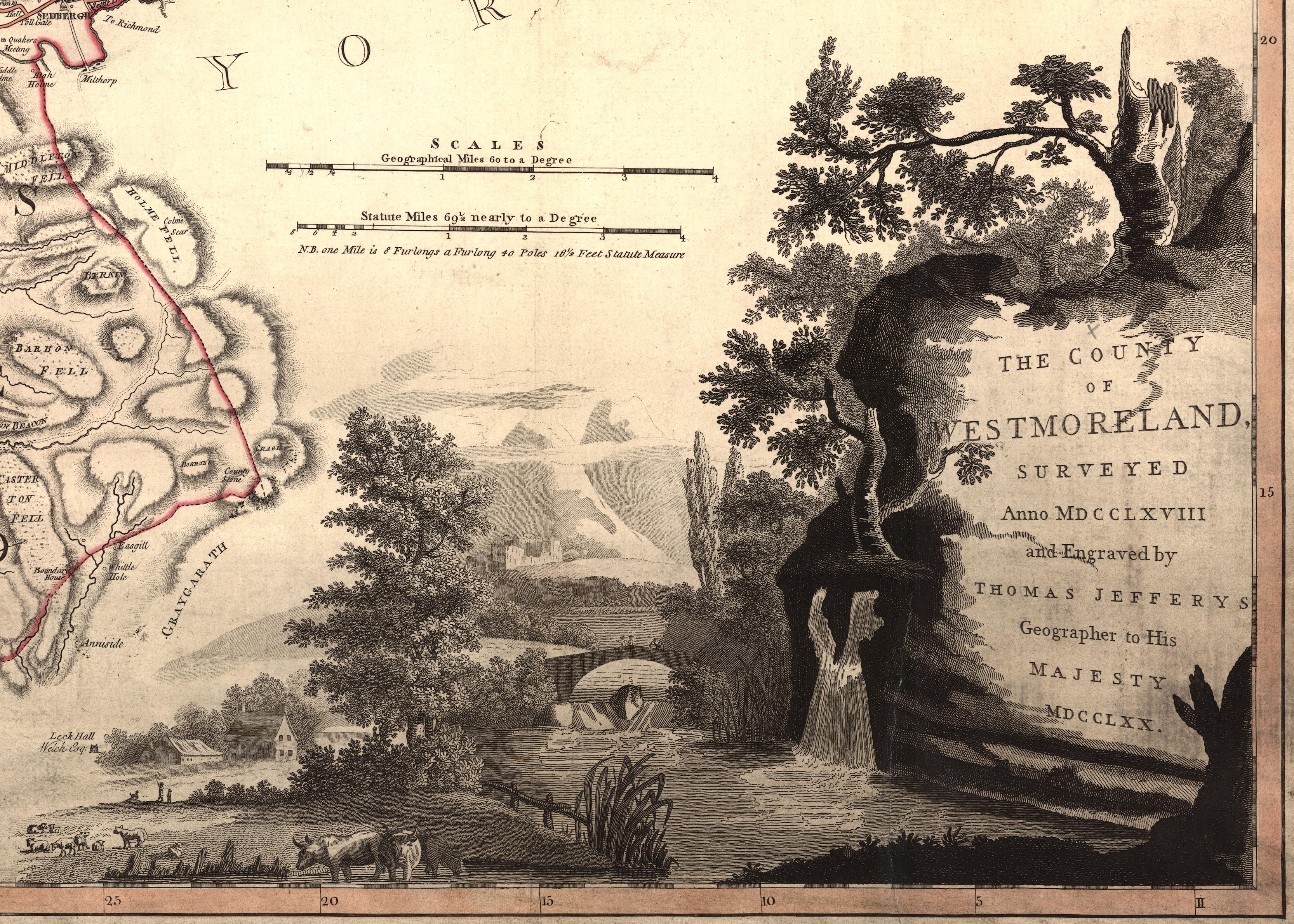
Map, 2x2 sheets, The County of Westmoreland, scale 1 inch to 1 mile, surveyed 1768, and engraved and published by Thomas Jefferys, London, 1770. (Jefferys 1770)
Lakes Guides menu.
 Lakes Guides menu.