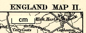
 England Map II

|

|
|
|
map type:- Cassell 1893 |
|
|
|
Map, England Map II and other sheets, scale about 7 miles
to 1 inch, by W and A K Johnston, Edinburgh and London, and
by Cassell and Co, London, 1893-98.
Probably issued in Cassell's Gazetteer of Great Britain and Ireland. |
||
|
(example JandMN (449))
|
||
| map feature:- | up is N & scale line & sea plain & coast tinted & rivers & lakes & relief & hill hachuring & county & settlements & roads & railways & shipping routes | |
| inscription:- |
printed top
Map I. Page I. ENGLAND MAP II. |
|
| inscription:- |
printed right
Map. III. Page 97. |
|
| inscription:- |
printed bottom
W. & A. K. Johnston, Edinburgh & London. / Cassell & Company Limited, London. / Map IV. Page 145. / ... |
|
| wxh, sheet:- | 31x25cm | |
| wxh, map:- | 264x189mm | |
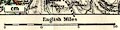
| inscription:- |
printed with scale line
English Miles |
|
| scale line:- | 10+5 miles = 54.4 mm | |
| scale:- | 1 to 440000 ? (1 to 443753 from scale line) | |
|
||
| sources:- |
JandMN Collection |
|
| items seen (illustrated items in bold):- | ||

|
JandMN (449) -- map -- England Map II | |