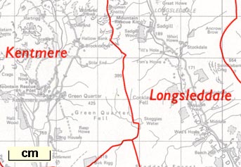

OS 1974 Admin Areas

The maps show local authority areas, in particular county and civil parishes, after local government reorganisation in 1974, and later revisions. Revisions will have altered boundaries, of parishes and other areas which are not stable; also note that altitudes on the 1974 sheets are in feet and on later sheets are in metres.
ORDNANCE SURVEY / CUMBRIA / (NORTH PART) / ADMINISTRATIVE AREAS DIAGRAM / SHOWING THE BOUNDARIES OF : / THE COUNTY, DISTRICTS AND CIVIL PARISHES, /AS NOTIFIED TO 1-8-80; / THE EUROPEAN CONSTITUENCY / UNDER THE EUROPEAN ASSEMBLY ELECTIONS ACT 1978, / AS NOTIFIED TO 1-8-80; / AND THE PARLIAMENTARY CONSTITUENCIES / AS NOTIFIED TO 1-4-74. / ...
ORDNANCE SURVEY / CUMBRIA / (SOUTH PART) / ADMINISTRATIVE AREAS DIAGRAM / SHOWING THE BOUNDARIES OF / THE COUNTY, DISTRICTS AND CIVIL PARISHES /AS NOTIFIED TO 1-5-92 / AND THE PARLIAMENTARY CONSTITUENCIES / REVISED TO 1-5-92 / ...
 Cumbria, North Part