 Geological Map of Westmoreland

|

|
|
|
map type:- Smith 1824 |
|
|
|
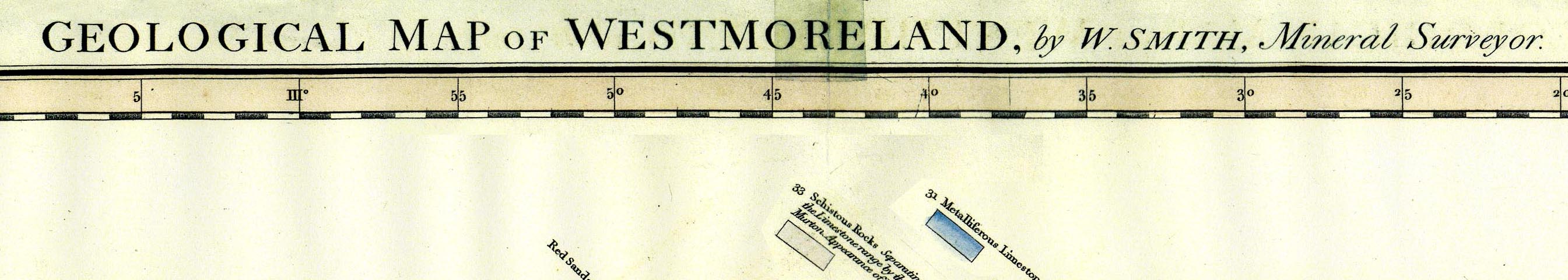
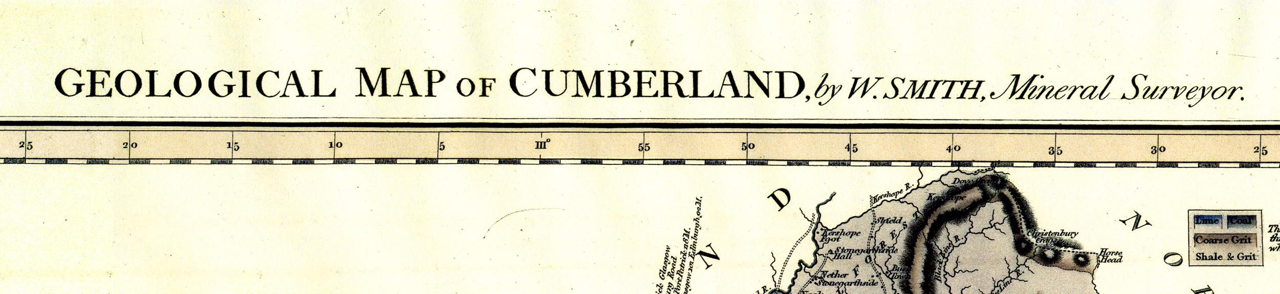
Geological Maps, Geological Map of Westmoreland, scale
about 2.5 miles to 1 inch, and Geological Map of Cumberland,
scale about 3.5 miles to 1 inch, by William Smith, published
by John Cary, 86 St James's Street, London, 1824.
The maps are coloured on county maps by John Cary, from Cary's New English Atlas, 1809. The maps are in a series of 21 county geological maps published from 1819 to 1824. |
||
|
(map example BL:Maps 5610 (1))
|
||
| inscription:- |
printed top
GEOLOGICAL MAP OF WESTMORELAND, by W. SMITH, Mineral Surveyor. |
|
| inscription:- |
printed lower right
A /NEW MAP / OF / WESTMORLAND, / DIVIDED INTO WARDS, / EXHIBITING / Its Roads, Rivers, Parks &c. / By JOHN CARY Engraver. / 1824. |
|
|
||
| sources:- |
British Library (Maps 5610 (1)) Carlisle Library Maps |
|
| items seen (illustrated items in bold):- | ||

|
Carlisle Library : Map 33 -- geological map -- Geological Map of Cumberland -- New Map of Cumberland | |
|
|
Carlisle Library : Map 58 -- geological map -- Geological Map of Westmoreland -- New Map of Westmoreland | |
|
|
Sedgwick Archive : map 86 -- map case -- Geological Map of Westmoreland -- New Map of Westmoreland | |
|
|
Sedgwick Archive : map 97 -- map case -- Geological Map of Cumberland -- New Map of Cumberland | |