 Map Illustrating A Wander Week in Westmorland

|

|
|
|
map type:- Kirkby 1914 map |
|
|
|
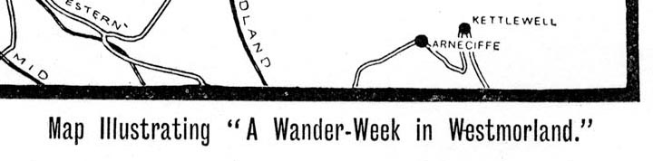
Map Illustrating A Wander Week in Westmorland, scale
about 9 miles to 1 inch, published by J W Braithwaite,
Market Square, Kirkby Stephen, Westmorland, 1914.
Included in A Wander Week in Westmorland, by Bryham Kirkby. |
||
|
(example Kendal Library (27))
|
||
| map feature:- | compass rose & up is N & scale line & table of symbols (just rails and roads) & lakes & settlements & roads & railways | |
| inscription:- |
printed bottom left, right
J. W. BRAITHWAITE & SONS, PRINTERS, KIRKBY STEEPHEN. / Map Illustrating 'A Wander-Week in Westmorland.' |
|
| inscription:- |
printed with scale line
SCALE 5 MILES |
|
| wxh, map:- | 164x138mm (roughly) | |
| scale line:- | 5 miles = 14.5mm (approx) | |
| scale:- | 1 to 550000 ? (1 to 554946 from scale line, roughly) | |

|
||

|
||
| sources:- |
Kendal Library |
|
| items seen (illustrated items in bold):- | ||

|
Kendal Library (27_1) -- map -- Map Illustrating A Wander Week in Westmorland | |