 Cobbett 1832

|

|
|
|
map type:- Cobbett 1832 |
|
|
|
Maps, Westmoreland, scale about 7 miles to 1 inch, and
Cumberland, scale about 20 miles to 1 inch, by William
Cobbett, 11 Bolt Court, Fleet street, London, 1832.
The distorted shapes are not recognisable or useful transformations of reality. Published in 'A Geographical Dictionary of England and Wales ... each county is also preceded by a Map, showing, in the same manner, the local situations of the Cities, Boroughs and Market-towns, ... By William Cobbett. London: published by Wm. Cobbett, 11, Bolt-Court, Fleet-Street ... 1832.' Cobbett advertises this atlas in his Rural Rides, 1830 edition, 'A GEOGRAPHICAL DICTIONARY OF ENGLAND AND WALES; containing the names, in Alphabetical Order, of all the Counties, with their several Subdivisions into Hundreds, Lades, Rapes, Wapentakes, Wards, or Divisions; and an Account of the Distribution of the Counties into Circuits, Dioceses, and Parliamentary Divisions. Also, the names (under that of each County respectively), in Alphabetical Order, of all the Cities, Boroughs, Market Towns, Villages, Hamlets, and Tithings, with the Distance of each from London, or from the nearest Market Town, and with the Population, and other interesting particulars relating to each; besides which there are MAPS; first, one of the whole country, showing the local situation of the Counties relatively to each other; and, then, each County is also preceded by a Map, showing, in the same manner, the local situation of the Cities, Boroughs, and Market Towns. FOUR TABLES are added; first, a Statistical Table of all the Counties; and then three Tables, showing the new Divisions and Distributions enacted by the Reform-Law of 4th June, 1832.' and says:- 'This book was suggested to me by my own frequent want of the information which it contains; a suggestion which, if every compiler did but wait to feel before he put his shears to work, would spare the world of many a voluminous and useless book. I am constantly receiving letters out of the country, the writers living in obscure places, but who seldom think of giving more than the name of the place they write from; and thus have I been often puzzled to death to find out even the county in which it is, before I could return an answer. I one day determined, therefore, for my own convenience, to have a list made out of every parish in the kingdom; but this being done, I found that I had still townships and hamlets to add in order to make my list complete; and when I had got the work only half done, I found it a book; and that, with the addition of bearing, and population, and distance from the next market-town, or if a market-town, from London, it would be a really useful Geographical Dictionary. It is a work which the learned would call sui generis; it prompted itself into life, and it has grown in my hands; but I will here insert the whole of the title-page, for that contains a full description of the book. It is a thick octavo volume, price 12s.' The atlas size is 5 1/8 x 7 1/2 ins; the maps have county boundary and some towns, and are very distorted. Published in a 2nd edition, a larger map? 1854. |
||
|
(example map JandMN (116))
|
||
| map feature:- | plain cartouche & north point & up is NW (roughly) & county & settlements | |
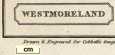
| inscription:- |
printed title cartouche, lower left
WESTMORELAND |
|
| inscription:- |
printed bottom
Drawn & Engraved for Cobbett's Geographical Dictionary of England and Wales. |
|
| wxh, sheet:- | 12.5x22cm | |
| wxh, map:- | 101x173mm | |
| scale:- | 1 to 460000 ? (very rough estimate) | |
| references:- |
Cobbett, William: 1832 & 1854: Geographical Dictionary of
England and Wales: (London) Biddell, Barabara: 1999: Jolly Farmer? William Cobbett in Hampshire, 1804-1820, The: Hampshire CC (Winchester, Hampshire):: ISBN 1 859725 247 0 |
|
| sources:- |
Chubb 1927 JandMN Collection Armitt Library |
|
| items seen (illustrated items in bold):- | ||

|
Armitt Library : ALMC2008.14.42 -- map -- Westmoreland | |
|
|
JandMN (116) -- map -- Westmoreland | |
|
|
JandMN (117) -- map -- Cumberland | |