 Cobbett 1832

|

|
|
|
item:- Armitt Library : ALMC2008.14.42 image:- © see bottom of page |
click to enlarge |
|
|
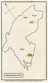
Map, uncoloured engraving, Westmoreland ie Westmorland,
scale about 7 miles to 1 inch, by William Cobbett, 11 Bolt
Court, Fleet Street, London, 1832.
Included in A Geographical Dictionary of England and Wales; the distorted shape is not a recognisable or useful transformation of reality. |
||

|
Cobbett 1832 | |
| map feature:- | plain cartouche & north point & up is NW (roughly) & county & settlements | |
| inscription:- |
printed title cartouche, lower left
WESTMORELAND |
|
| inscription:- |
printed bottom
Drawn & Engraved for Cobbett's Geographical Dictionary of England and Wales. |
|
| wxh, sheet:- | 14x22cm | |
| wxh, map:- | 100x173mm | |