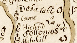
Map, ms ink on parchment, A Platt of the Opposete Borders of Scotland to ye West Marches of England, scale about 2.5 miles to 1 inch, drawn for Lord Burghley, 1590. (Burghley 1590)
Lakes Guides menu.
 Lakes Guides menu.