 Lakes in Lancashire and Westmorland

|

|
|
|
map type:- Housman 1800 map 4 |
|
|
|
Maps, Lakes in Lancashire and Westmorland, 7 lakes on one
sheet, engraved by McIntyre, Edinburgh, published by F
Jollie, Carisle, Cumberland, and C Law, Ave Maria Lane,
London, 1800.
The lakes are - Grasmere Water, Rydal Water, Easthhwaite Water and perhaps Out Dubs Tarn, Coniston Water, Haws Water, Ulles Water, Windermere Water with Curwins Island. Included in A Descriptive Tour, and Guide to the Lakes, Caves, Mountains ..., by John Housman; published 1800-21. |
||

|
Lowes 1790s | |
|
(map example Dove Cottage : 2007.38.97)
|
||
| map feature:- | north point & rivers & lakes & relief & hill hachuring & woods & trees & parks & settlements & roads | |
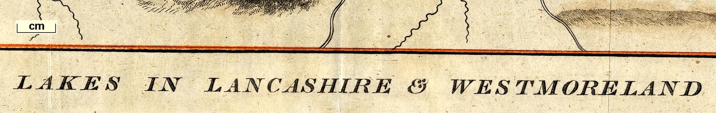
| inscription:- |
printed bottom
LAKES IN LANCASHIRE & WESTMORELAND |
|
| inscription:- |
printed lower right
Mc.Intyre Sculpsit Edinr. |
|
| wxh, sheet:- | 34x22cm (approx) | |
| wxh, map:- | 317x194mm | |
| sources:- |
Bicknell 1990 Wordsworth Trust Collection JandMN Collection |
|
| items seen (illustrated items in bold):- | ||
|
|
Carlisle Library : Map 69 -- map -- Lakes in Lancashire and Westmoreland | |
|
|
Dove Cottage : 2007.38.97 -- map -- Lakes in Lancashire and Westmorland | |
|
|
JandMN (233_9) -- map -- Lakes in Lancashire and Westmoreland | |