 Hawick and Eskdale

|

|
|
|
map type:- OS 1970s Landranger |
|
|
|
Map series, Landranger series maps of Great Britain, 'One
Inch' maps metricated, scale 1 1/4 inches to 1 mile,
published by the Ordnance Survey, Southampton, Hampshire,
from about 1976.
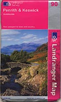
The metric equivalents of the one inch maps were first produced as photographic enlargements from the earlier series, southern areas 1974, northern areas 1976. The series is continuously updated. The sheets that concern Westmorland, Cumberland, and the parts of Lancashire north of the sands, and of Yorkshire, that became Cumbria are:- sheet 79 - Hawick and Eskdale Sheet 80 -The Cheviot Hills sheet 85 - Carlisle and Solway Firth Sheet 86 - Haltwhistle and Bewcastle Sheet 87 - Hexham and Haltwhistle Sheet 89 - Workington and Whitehaven Sheet 90 - Penrith and Keswick Sheet 91 - Appleby-in-Westmorland Sheet 92 - Barnard Castle and Richmond Sheet 96 - Barrow-in-Furness Sheet 97 - Kendal and Morecambe Sheet 98 - Wensleydale and Upper Wharfdale |
||
|
||
| references:- |
Hellyer, Roger: 1999: Ordnance Survey Small Scale Maps:
Archer, David (Kerry, Montgomeryshire):: ISBN 0 9517579 5
4 |
|
| sources:- |
JandMN Collection |
|
| sources:- |
OSV8Cum.txt |
|