 Coast of England on the Irish Sea

|

|
|
|
map type:- Dury 1764 |
|
|
|
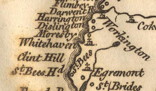
Map and chart of the coast of England on the Irish Sea,
part of Lancashire, Cumberland, and the coast of Scotland,
showing the Isle of Man, scale about 22 miles to 1 inch,
perhaps by John Rocque, published by Andrew Dury, Dukes
Court, London, 1764.
Published in 'A Collection of Plans of the Principal Cities of Great Britain and Ireland, with Maps of the Coast of the said Kingdoms.' Another sheet in the atlas, the south west coast of Scotland, shows the Solway Firth with part of Cumberland. |
||
| references:- |
Dury, Andrew: 1764: Collection of Plans of the Principal
Cities of Great Britain and Ireland, with Maps of the Coast
of the said Kingdoms: Dury, Andrew (London) |
|
| sources:- |
Sandford-Johnson Collection Wordsworth Trust Collection Dumfries Museum |
|
| items seen (illustrated items in bold):- | ||

|
Dove Cottage : Lowther.1 -- chart | |
|
|
Dumfries Museum : 1981.152 -- chart | |