 Dury 1764

|

|
|
|
item:- Dumfries Museum : 1981.152 image:- © see bottom of page |
click to enlarge |
|
|
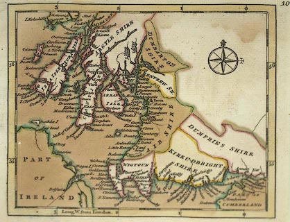
Chart, hand coloured engraving, the coast of Scotland on
the Irish Sea, North Channel and Atlantic, scale perhaps
about 22 miles to 1 inch, perhaps by John Rocque, published
by Andrew Dury, Dukes Court, London, 1764.
Published in A Collection of Plans of the Principal Cities of Great Britain and Ireland, with Maps of the Coast of the said Kingdoms. |
||

|
Dury 1764 | |
| map feature:- | compass rose & up is N & lat and long scales & sea plain & coast form lines & rivers & county & settlements | |
| scale:- | 1 to 1400000 ? (guess, as other map in series) | |
| wxh, map:- | 124x104mm (approx) | |