 Map of the Lakes of Cumberland, Westmoreland and
Lancashire
Map of the Lakes of Cumberland, Westmoreland and
Lancashire

|

|
|
|
map type:- Hudson 1842 map |
|
|
|
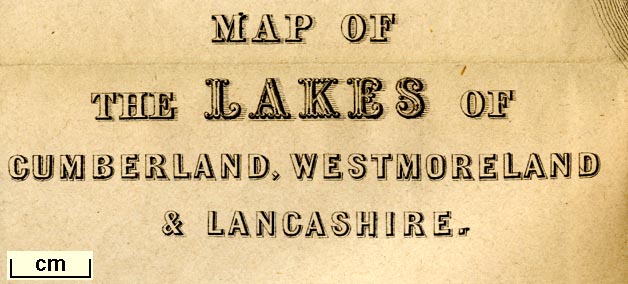
Map of the Lakes of Cumberland, Westmoreland and
Lancashire, scale about 3.5 miles to 1 inch, and other maps,
engraved by William Banks, Edinburgh, published by John
Hudson, Kendal, Westmorland, 1853.
Included in A Complete Guide to the Lakes, edited John Hudson. There also maps - Eight Miles round Grasmere, and the Vicinity of Keswick. |
||
|
(example JandMN (327_13))
|
||
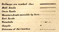
| map feature:- | folded (4x3) & table of symbols & north point & up is N & scale line & sea plain & coast form lines & rivers & lakes & relief & hill hachuring & forests & parks & county & settlements & roads & canals & railways (perhaps engraved over an earlier version) | |
| inscription:- |
printed lower left
MAP OF / THE LAKES OF / CUMBERLAND, WESTMORELAND / & LANCASHIRE |
|
| inscription:- |
printed bottom right, centre
Willm. Banks, Engraver, Edinr. / Published by John Hudson, Kendal. |
|
| wxh, sheet:- | 31.5x38cm | |
| wxh, map:- | 294x363mm | |
| inscription:- |
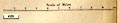
printed with scale line
Scale of Miles |
|
| scale line:- | 10 miles = 73.1 mm | |
| scale:- | 1 to 220000 ? (1 to 220156 from scale line) | |
|
||
|
||
| sources:- |
JandMN Collection |
|
| items seen (illustrated items in bold):- | ||

|
JandMN (327_4) -- map -- Eight Miles round Grasmere | |
|
|
JandMN (327_5) -- map -- Vicinity of Keswick | |
|
|
JandMN (327_13) -- map -- Map of the Lakes of Cumberland, Westmoreland and Lancashire | |