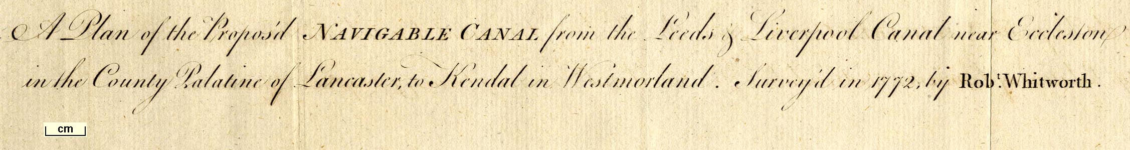
 Plan of the Proposed Navigable Canal ... to
Kendal
Plan of the Proposed Navigable Canal ... to
Kendal

|

|
|
|
map type:- Whitworth 1772 |
|
|
|
Canal map, Plan of the Proposed Navigable Canal ... to
Kendal, scale about 4 miles to 1 inch, by Robert Whitworth,
published by the Gentleman's Magazine, 1772.
Tipped in opposite vol.42 supplement p.608. |
||
|
(example Armitt Library : A5735 (3)
|
||
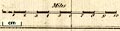
| map feature:- | compass rose & up is W & scale line & rivers & relief & hill hachuring & settlements & roads & canals & table of data (distances and levels on the canal) | |
| inscription:- |
printed top right
Gent. Mag. Suppplement 1772. |
|
| inscription:- |
printed upper centre
A Plan of the Proposed NAVIGABLE CANAL from the Leeds & Liverpool Canal near Eccleston / in the County Palatine of Lancaster, to Kendal in Westmorland. Survey'd in 1772, by Robt. Whitworth. |
|
| wxh, sheet:- | 25x2136.5x21.5cm | |
| wxh, map:- | 311x166mm | |
| inscription:- |
printed with scale line
Miles |
|
| scale line:- | 10 miles = 61.8 mm | |
| scale:- | 1 to 260000 ? (1 to 260412 from scale line) | |
|
||
| sources:- |
Armitt Library |
|
| items seen (illustrated items in bold):- | ||

|
Armitt Library : Gents Mag 1772.1 -- canal map -- Plan of the Proposed Navigable Canal ... to Kendal | |