 MacKenzie 1893

|

|
|
|
map type:- MacKenzie 1893 |


|
|
|
Maps, Westmorland, scale about 4.5 miles to 1 inch, and
Cumberland, scale about 6.5 miles to 1 inch, by F S Weller,
published by William MacKenzie, London, etc, about 1893.
|
||
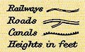
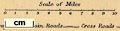
| map feature:- | table of symbols & up is N & scale line & lat and long scales & lat and long grid & sea tinted & coast line & rivers & lakes & relief & hill hachuring & county & electoral data & settlements & roads & canals & railways | |
| inscription:- |
printed lower right
WESTMORLAND |
|
| inscription:- |
printed bottom centre and right
WILLIAM MACKENZIE, LODON, EDINBURGH & GLASGOW. / F. S. Weller, F.R.G.S. |
|
| wxh, sheet:- | 32x26cm | |
| wxh, map:- | 279x215mm | |
| scale line:- | 10 miles = 56.0 mm | |
| scale:- | 1 to 290000 ? (1 to 287383 from scale line) | |

|
||
|
||
|
||
| sources:- |
JandMN Collection Wordsworth Trust Collection |
|
| items seen (illustrated items in bold):- | ||

|
Dove Cottage : 2007.38.81 -- map -- Westmorland | |
|
|
Dove Cottage : 2009.81.19 -- map -- Cumberland | |
|
|
JandMN (222) -- map -- Cumberland | |