 Reynolds's Geological Atlas of Great Britain

|

|
|
|
map type:- Reynolds 1860s |
|
|
|
Geological maps, descriptive text, etc, Reynolds's
Geological Atlas of Great Britain, published by James
Reynolds, 174 Strand, new edition, 1860s?
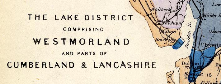
The atlas has a geological essay on the structure of Great Britain, some notes about each county, and county geological maps, etc. The preface states that the following authorities were consulted - The Maps of the Geological Survey of Great Britain; Greenough's fine Map issued by the Geological Society; The Maps of Phillips, Murchison, Knipe, Ramsay, and Forbes; The Works of Sir Charles Lyell, Professors Phillips, Ansted, &c.; Mr. Prestwich on 'The Strata around London.'; Professor Forbes and Mr. Bristow on 'The Isle of Wight.'; Dr. Fitton on 'The Strata below the Chalk.'; Sir Roderick Murchison's 'Siluria.'; Rev. J. G. Cumming on 'The Isle of Man.' &c. The maps are coloured on base maps engraved by John Emslie, published by James Reynolds, 1848 onwards. The following maps concern Westmorland, Cumberland, etc:- plate 1 - England and Wales. plate 7 - North Cumberland. plate 8 - The Lake District, comprising Westmorland and parts of Cumberland and Lancashire. plate 12 - Durham. plate 18 - West Yorkshire and Lancashire. plate 23 - Northumberland. |
||
|
(example Armitt Library : A4027)
|
||
| book feature:- | rebound (using parts of original cloth) & cloth bound & frontispiece (mountains and hills) & title page (new edn) & title page (1st edn?) & list of plates & preface & stratigraphical column & text (pp.1-32 on geology) & gazetteer (pp.1-12 tourist guide) & maps (32 general and county geological maps) | |
| inscription:- |
embossed spine
GEOLOGICAL / ATLAS / OF / GREAT / BRITAIN gold on brown |
|
| inscription:- |
embossed cover
GEOLOGICAL ATLAS / OF / GREAT BRITAIN / FROM THE / GOVERNMENT SURVEY &C. gold on brown |
|
| inscription:- |
printed title page (new edn)
REYNOLDS'S / GEOLOGICAL ATLAS / OF / GREAT BRITAIN; / COMPRISING / A SERIES OF MAPS GEOLOGICALLY COLOURED, / PRECEDED BY A / DESCRIPTION OF THE GEOLOGICAL STRUCTURE OF GREAT BRITAIN, / AND THE / GEOLOGICAL FEATURES OF THE SEVERAL COUNTIES / OF / ENGLAND & WALES, / MINERAL PRODUCTS &C; / WITH SECTIONS & VIEWS. / NEW EDITION. / / London, Published by James Reynolds, 174, Strand. |
|
| inscription:- |
printed title page (1st edn?)
REYNOLDS'S / GEOLOGICAL ATLAS / OF / GREAT BRITAIN, / COMPRISING / A SERIES OF MAPS GEOLOGICALLY COLOURED, / FROM THE BEST AUTHORITIES; / PRECEDED BY A / DESCRIPTION OF THE GEOLOGICAL STRUCTURE OF GREAT / BRITAIN, AND THE GEOLOGICAL FEATURES OF / THE SEVERAL COUNTIES OF ENGLAND AND WALES, / MINERAL PRODUCTS. &C. / WITH / SECTIONS AND VIEWS. / / LONDON : JAMES REYNOLDS, 174, STRAND. |
|
| inscription:- |
printed end of texts
LONDON : W. J. JOHNSON, PRINTER, 121, FLEET STREET. |
|
| wxh:- | 12.5x19cm | |
| wxh, page:- | 12x18.5cm | |
| sources:- |
Armitt Library |
|
| items seen (illustrated items in bold):- | ||

|
Armitt Library : A4027 -- atlas -- Reynolds's Geological Atlas of Great Britain | |
|
|
Armitt Library : A4027.1 -- geological map -- England and Wales | |
|
|
Armitt Library : A4027.7 -- geological map -- North Cumberland -- Isle of Man | |
|
|
Armitt Library : A4027.8 -- geological map -- Lake District -- Westmorland and parts of Cumberland and Lancashire | |
|
|
Armitt Library : A4027.12 -- geological map -- Durham | |
|
|
Armitt Library : A4027.18 -- geological map -- West Yorkshire and Lancashire | |
|
|
Armitt Library : A4027.23 -- geological map -- Northumberland | |