 Tymms 1832-43

|

|
|
|
map type:- Tymms 1832-43 map |
|
|
|
Maps, Westmorland, and Cumberland, by Samuel Tymms,
published by J B Nichols and Son, 25 Parliament Street,
1837.
Included in The Family Topographer, vol.6. |
||
|
(example Armitt Library : ALMC2008.14.125.1)
|
||
| map feature:- | north point & up is N & coast form lines & rivers & lakes & parks & county & settlements & roads & canals & road distances (possibly, the figures by some roads) | |
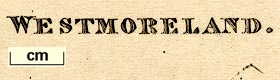
| inscription:- |
printed lower left
WESTMORELAND. |
|
| inscription:- |
printed bottom
Published 1838, by J. B. Nichols & Son. 25, Parliament Street. |
|
| wxh, sheet:- | 17x10cm | |
| wxh, plate:- | 135x86mm | |
| wxh, map:- | 124x76mm | |
| sources:- |
Armitt Library |
|
| items seen (illustrated items in bold):- | ||

|
Armitt Library : ALMC2008.14.125.1 -- map -- Westmoreland | |
|
|
JandMN (331) -- map -- Westmoreland | |
|
|
JandMN (332) -- map -- Cumberland | |