 Tymms 1832-43 map

|

|
|
|
item:- JandMN (331) image:- © see bottom of page |
click to enlarge |
|
|
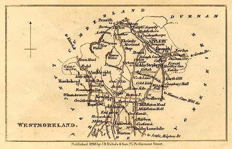
Map, uncoloured engraving, Westmoreland, by Samuel Tymms,
published by J B Nichols and Son, 25 Parliament Street,
1838.
Included in The Family Topographer, vol.6. |
||

|
Tymms 1832-43 map | |
| map feature:- | north point & up is N & coast form lines & rivers & lakes & parks & county & settlements & roads & canals & road distances (possibly, the figures by some roads) & distances from London | |
| inscription:- |
printed lower left
WESTMORELAND. |
|
| inscription:- |
printed bottom
Published 1838, by J. B. Nichols & Son. 25, Parliament Street. |
|
| wxh, sheet:- | 15.5x10cm | |
| wxh, plate:- | 134x87mm | |
| wxh, map:- | 124x76mm | |