 Principal Mountains of Westmorland and Cumberland

|

|
|
|
map type:- Batty 1888 |
|
|
|
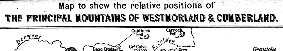
Map, Principal Mountains of Westmorland and Cumberland,
scale about 4.5 miles to 1 inch, by E C Batty, published by
Sampson Low, Marston, Searle, and Rivington, St Dunstan's
House, Fetter Lane, Fleet Street, London, 1888.
Opposite p.208 in Mountain Ascents in Westmoreland and Cumberland by John Barrow. |
||
|
(map example Kendal Library (10_1))
|
||
| map feature:- | ||
| inscription:- |
printed top
Map to shew the relative positions of THE PRINCIPAL MOUNTAINS OF WESTMORLAND & CUMBERLAND. |
|
| inscription:- |
printed bottom, left and right
Compiled by E. C. Batty. / To face page 208. |
|
| wxh, map:- | 151x204mm | |
| scale:- | 1 to 300000 ? (estimate) | |
| sources:- |
Kendal Library Maps |
|
| items seen (illustrated items in bold):- | ||

|
Kendal Library (10_1) -- map -- Principal Mountains of Westmorland and Cumberland | |