 Lancashire

|

|
|
|
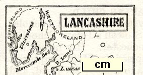
map type:- Children's Friend 1869 |
|
|
|
Maps, thumbnail size, Lancashire, and presumably
Westmorland and Cumberland, published in The Children's
Friend, by S W Partridge and Co, London, 1869..
The Lancashire map illustrateu Hierographical Readings No.XXI, a rebus description of the county. The magazine was begun by Rev William Carus Wilson, b.1792 d.1859, in 1824, and was published until 1930. |
||
|
(example JandMN (422))
|
||
| map feature:- | plain cartouche & up is N & sea plain & coast form lines & rivers & lakes & county & settlements | |
| inscription:- |
printed plain cartouche, upper right
LANCASHIRE |
|
| wxh, sheet:- | 15x20cm | |
| wxh, map:- | 33x43mm | |
| sources:- |
JandMN Collection |
|
| items seen (illustrated items in bold):- | ||

|
JandMN (422) -- map -- Lancashire -- Hierographical Readings | |