 Perrot 1823

|

|
|
|
map type:- Perrot 1823 |
|
|
|
Map, Cumberland, Westmoreland, scale about 38 miles to 1
inch, by Aristide Michel Perrot, engraved by Migneret, 1823,
published by Etienne Ledoux, 9 Rue Guenegaud, Paris, France,
1824; published 1824-48.
Published in 'L'ANGLETERRE, OU DESCRIPTION HISTORIQUE ET TOPOGRAPHIQUE DU ROYAUME-UNI DE LA GRANDE-BRETAGNE CONTENTANT Les comtes de la principaute de Galles, des royaumes d'Ecosse, d'Irelande at d'Angleterre, les iles Orcades, Shetland, etc. PAR M. G.-B. DEPPING, [ ] DE 75 CARTES ET VUES. TOME 1. A PARIS CHEZ ETIENNE LEDOUX, LIBRAIRE, RUE GUENEGAUD, No 9. 1824.' Published again in Paris, France and Brussels, Belgium, 1828. |
||
|
(map example Dove Cottage : 2007.38.45)
|
||
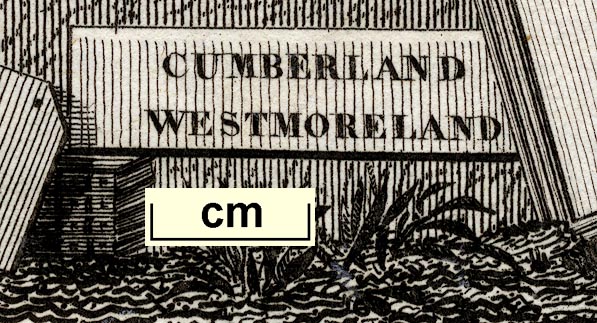
| map feature:- | plain cartouche & up is N & coast form lines & rivers & lakes & relief & hill hachuring & county & settlements | |
| inscription:- |
printed title cartouche
CUMBERLAND / WESTMORELAND |
|
| inscription:- |
printed bottom left and right
A. M. Perrot 1823 / Me. Migneret Sc. |
|
| wxh, sheet:- | 8.5x14cm | |
| wxh, map:- | 6.5x11cm | |
| scale:- | 1 to 2400000 ? (estimate) | |
| references:- |
Perrot, A M: 1824: Angleterre & Description Historique et
Topographique du Royaume-Uni de la Grande-Bretagne: Ledoux,
Etienne (Paris, France) |
|
| sources:- |
Wordsworth Trust Collection Armitt Library |
|
| items seen (illustrated items in bold):- | ||

|
Armitt Library : ALMC2008.14.76 -- map -- Cumberland -- Westmoreland | |
|
|
Dove Cottage : 2007.38.45 -- map -- Cumberland -- Westmoreland | |